Wednesday, November 6, 2013

High Point to Delaware Water Gap on the AT

It's a surprisingly difficult task to organize a group of friends to hike and camp for a weekend trip. Firstly, there is the debate about where to go, then where to camp, the need for water and food, how many cars are required for seven guys, where to park, who shuttles with who and so on.  I was in Los Angeles when the gang met at Mauro's to decide a location and I phoned in to suggest High Point  to Stokes along the AT. I was honest and said it was on my hit list of hikes, but moreover there are shelters, some water and parking at various locations. Next meeting was over breakfast at the "cave" and we called the parks and learned that no ground fires were permitted on the AT in NJ and one of our parking options was also not available overnight.  We decided to camp night one at Mashipacong shelter near rt 650 and the next night use one of Stokes camp areas called Steam Mill campground so we could build a fire and warm up and have a proper steak dinner in camp. We had a plan where five would be hiking from High Point and the other two meet up the next day. Unfortunately later that day my friend Roman, who is an avid cyclist, was popped by a car on a ride and was banged up pretty bad and was out completely for the hiking.  Later in the week, another two guys dropped out of the first day's activities but would still meet up to hike and camp on day two and provide team one a shuttle back on day 3.  Whew, like I said, it's complicated anytime more than two people are involved.


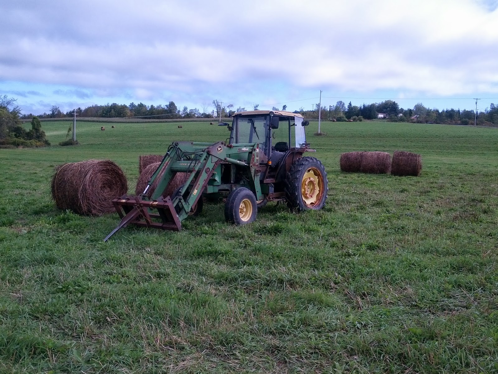
What started as six or seven whittled down to three, so Mauro, Frankie and I drove to the AT parking area at High Point on  Rt 23 and briskly walked northbound, stopping at the scenic high point viewing pavillion and monument before looping back to the car to put the packs on. This little loop both warmed our legs up and covered a small section I needed before heading south. I bought a new Osprey Volt 60 internal frame pack and while I hoped to travel lighter, I found water food and cool weather gear weighed in much heavier than desired. The day was bright and cold, but warmed as we walked. The wind was gusting and the sky clear and blue.  We dropped packs here and there and enjoyed a non hurried day. We dropped off trail to check out the Rutherford shelter and to eat lunch there. We were humored to see a fake satellite dish, tv remote control and dummy electrical outlet affixed to the shelter. I guess it is a fun joke to tease those away from such luxuries for many weeks on end.


SWEAT (JOE)

We later arrived at the Mashipacong shelter to find another hiker setting up camp in the shelter with a new 5gallon water bottle sitting beside him on the picnic table.  His name was Joe and he said his buddy dropped off the water as a gift for him and others like us. He had previously thru hiked the AT ( I think he said in the 90's) and his trail name back then was SWEAT, which besides the literal meaning, was an acrynym for Slowly Walking the Entire Appalachian Trail. We also learn it was his 53 birthday. We celebrated by sharing good food, stories, drinks and cigars.  It was quite cold and windy and I retired to my hammock and bag to curl in and warm  up. I was protected by a tarp but was chilled and slept little. I learned I needed to add Velcro straps to close the hammock over my face area to keep in more heat on windy nights. That's a modification I'll do soon.


We woke and had a simple breakfast of coffee, oatmeal and hard oiled eggs.  We said goodbye to Joe and hiked southbound on the AT. We soon met up with friends Vinny, Jim, Rich and Jerry, who drove up today.  They parked one car at sunrise mt and another at the steam mill campsite. We hiked to Sunrise mountain and ate snacks at the parking area as we changed over to day packs.  The rest of the day was a fast hike to the next shelter for lunch and then a loop back to Steam Mill Camp area.  We made a fire, Frankie cooked awesome rib eye steaks and potatoes, and we tasted fine wine (and scotch) until Jerry and Jim left to go home and then a brisk downpour ended the evening festivities for good. We were so surprised at the sudden heavy rain that we just darted to our respective shelters for the night.   It was a cold rain, but I stayed warm and dry in my hammock as I set the tarp just above me to keep in the warmth.  I did get a little wet in the early morning from condensate falling back down on me, but overall it was decent nights. We dodged a bullet because we stupidly left some food stuff out and were lucky no bear entered the camp during the night. I put my former boy scout skills to the test and found some hot embers under the wet cinders and quickly restarted a smokey fire to begin warding off the morning chill. It was about 35F just after dawn.  Frankie rose to the occasion and cooked a great breakfast of eggs, bacon and sausages, along with juice and hot coffee.  This is the only hiking trip I know of where you can walk for two days and still gain considerable weight!
................................
November 8 - 9
I decided to go hiking and camp for one night to cover a stretch on the NJ - AT from Gren Anderson shelter in Stokes forest to Blue Mt Lakes Rd in the Delaware Gap National Park.  This was to be my first solo overnight trip and it was intended to test my skills in the colder November weather. The temperature would hit the low 30’s , it would be windy and the moon at only a crescent. I began to physically and mentally prepare for it and decided to travel as light as possible.  I left my tent and hammock home, electing instead to stay in the Brink Road shelter regardless of who shows up there.  I brought a therma-rest sleeping pad, space blanket to cover the pad, a cheap old down sleeping bag, a nylon bag liner and my sil-nylon tarp.  My night time clothing was polyester base layers, polyester hiking pants, two poly shirts, a fleece hoodie outer (my luxury item) and down jacket.  I had glove liners and a hat. I had more than enough to survive and stay warm.  I figured I’d just wear anything I needed, jump in the bag and curl up with the tarp as my wind block. 

I parked at Culvers Gap, left my gear in the car and hitched a ride on sunrise rd up to the trail near Gren Anderson shelter to start at 10AM. The wind was gusting about 30 knots and when I came close to the fire tower on the next hill, I heard voices up above.  There were several utility workers on the upper portion of the high cell tower busy working and shouting to each other over the cold wind.  
Highpoint in distance

I climbed the fire tower, but it was so windy, I came down fast because it wasn’t worth losing all my heat over the view since I only had on a base layer shirt. It started snowing a bit and I kept moving fast to stay warm.  As I approached Culvers Gap, I started thinking about my plan to keep the car there overnight, pick up my pack, walk to Brink Road shelter for the night and then go a bit forward in the morning before turning around and retrace all my steps back to Culvers Gap. That was the problem of not having someone to shuttle with, you could only go so far before having to turn around.  I suddenly thought to call the Stokes forest park office and I requested a favor shuttling my car to the southern end of Stokes (near Buttermilk falls) before dropping me back at Culvers gap.  The park office lady seemed eager to help so I finished the section and zipped over to the park office.  I was warmly greeted and followed a maintenance truck to the Buttermilk Falls overnight parking area (Possibly in Delaware Gap forest).  I ditched the car, chucked my gear in the PU bed and hopped in with a guy named Bob. He informed me he just helped in building the new Brink rd shelter and said it was real nice and had benches inside for sleeping and sitting.  He said it had a porch and was built from blow-downs produced after Sandy and Irene.  When I got back to Culvers gap, I thanked him for the ride, held out a tip and he waved it off saying it was his pleasure to help a hiker. Thank you Stokes!
Culvers lake
Kittatiny Ridge
I climbed the next ridge and looked over Culvers lake and the community.  There are several taverns; a pizza joint and Dales market (for resupply) about a mile or two off the trail in the town for those interested. The hike to Brinks Rd was quick and easy.  I ended up at the shelter at about 3PM.  Sunset was at 4:45 so I had plenty of time to set up camp.  On the last downhill, I was hoping the wind would die down so it wouldn’t be as chilly later.  I passed the old shelter and immediately made a bee line to the new one on the opposite side of the trail.  The shelter was very well built and the front elevated on the hill.  It felt like a little cottage with an open front. I was the only one there and claimed the back corner bench.  I began to pull things out of my pack and was disheartened to realize my 2L water bladder had leaked over half its contents into my down sleeping bag. Ugh.   A soaked down sleeping bag is useless on a cold night.  Luckily, my light down jacket was on top and dry so I quickly layered into my dry clothes and began addressing my problems.  I hung the bag over the railing on the shelter into the wind and now was seriously hoping the wind would stay brisk for the next few hours and dry out the down.  I squeezed out the excess water and fluffed the bag over every ten minutes in by shaking it.  I found the nearby water source and restocked the lost water, using my emergency water tabs to purify.  An area behind the new shelter had an existing small fire ring, logs for sitting and ample wood (a bit wet), so I elected to make a very small cooking fire and warm my hands.  My original plan was not to make a fire at all and respect the forest rules but that plan required me being wrapped in my dry sleeping bag for the duration.  I cooked dinner and cleaned up and relaxed for a few hours before stashing my food rations in the nearby bear box.  At about 7pm, four headlamps came streaming down the trail and a group of southbound through hikers came into the shelter zone in a happy singsong fashion. They said hi and they elected to use the older shelter on the other side of the trail. They likewise made a fire to ward off the cold.  A few more hours passed and before going to bed, I stopped over and said hello and we shared some treats.  They just resupplied at Dales market and ate a pizza buffet and the mood was good and we all had a sugar high from M&Ms and sugar wafers.  I admire them for attempting the AT in soon-to-be winter conditions.  I retreated to my shelter and was happy to find my sleeping bag dry enough for a comfortable sleep. I guess a cold brisk wind has many positive uses.  I need to keep that in mind before I rush to foolishly curse it next time.  It dried a completely soaked bag in about 5 hours.  I was actually warm enough to not wear the hoodie to bed and instead use it as my pillow (i.e my luxury item). 

The morning was just above freezing and I found some embers and restarted the fire just enough to warm my hands and boil some instant coffee.  I only had one small pot, so I added my oatmeal and walnuts directly into my hot coffee and enjoyed my mocha mash gruel. I was really relaxed then but something abruptly changed my mood.  At exactly 8am to the second, it sounded like a war zone. I heard what sounded like celebratory gunfire of hundreds of rapid fire shots from all over.  I booted up my phone and read that at 8am (11/9/13) begin the start of small game season began in NJ.   I pictured all those frigging yahoo’s waiting in the woods and valley’s for the exact second to hit eight am so they could open fire at anything that moved or cause the birds to take flight due to the gunshots.  I read NJ released 24,000 stocked pheasants that morning.  It sounded like a slaughter nearby and I wanted out of the area.

Merry Band of Thru-hikers
 I said goodbye to the merry band of through-hikers across the way who woke up later than me and gave them my nylon sleeping bag liner for extra warmth.  I knew I had extra fabric at home and will just sew up another to replace it.  They were really cool folks and I wish them good luck making it to Georgia this winter.

Looking into PA over Delaware Valley
- Interesting Rock placement

I hiked the AT southbound all morning and into the afternoon until I got to Blue Mountain Lake Road.  I was happy to make the road and turned around and walked on a park road called Skyline rd than ran back towards scenic Crater Lake.  I eventually crossed over the AT and headed a bit out of the way to check out Hemlock Lake. I saw fresh bear signs and moved on fast.  I crossed the ridge on a woods road and headed down Buttermilk Falls trail to the waiting car.  The falls were almost dry, but it appeared to be a great location in the wet season.  By this time, I was very hungry and craving a cheese steak sandwich for some reason. I stopped by the pizza place the other hikers mentioned in Culvers Lake and gobbled one up.  Being on the trail is pure freedom, but it is also the freedom to do without many things we take for granted. I plan on getting a cold weather sleeping back so I can do without several layers of clothes at night and will also make a light weight water proof stuff sack in case another water vessel leaks on me again.    

Saturday, September 21, 2013

A Picture Perfect Ending

09-13-13
I met Chris and Andrea on the way up and Chris jumped into my car to drive directly to the start near at Partridge Run rd. in Albany County.  Andrea would do other things during the day and then pick us up at the end, eat dinner with us and camp out on the trail.  As we drove, we passed a historic red brick school house that I just had to stop for and photograph.  It was a picture perfect day as you can see here.  We soon arrived and set out on our days trek of 13 miles.  We wound through the Partridge run park, finding wild apples, cherries and grapes present and we tasted them all.  We spit out the cherries and grapes since they were bitter, but the edible green apples reminded us fall is right around the corner. We came down the mountain into perfectly mowed field and a newly constructed shelter was at the long end of it.  It had a makeshift privy near by, a fire ring and a field for camping. We explored it and decided it would be a good lodging for the night and we would drive back here after dinner.  I was still considering an alternate location near then end of the next section, fox creek, but as it turned out later, we found that location terrible for camping due to wetness high clumped grass and no level ground. We road walked a long way, again through scenic Albany county, and we passed the time telling tall tales. The time and miles passed by very fast as this section and the previous section were both scenic at times, but relatively easy compared to the highlights of the bigger Catskills. We passed a doopler radar installation and the dome was an eye sore, but a landmark as well.  Soon thereafter, without fanfare, we exited to Rt. 443 from and Andrea waiting on the side of  Stage Road.

We had just walked 13 miles from 10:30 AM to 4:15 PM and I felt the best I had ever felt after a hike. We then went locally to the Hofbrau on Warners lake (in East Berne) for a hot dinner and cool music. After a good meal, we rushed out to pick up my car at the trail head and shuttle both cars to the shelter area near Gifford Hollow road (off Switzkill road). We arrived just as night was creeping in.  A nearby local immediately investigated us as we were parking on the grassy shoulder (on their land) and determined we were only hikers and said it was ok.  But she warned us about a bear and cub in the area.  We thanked her and decided to leave all food in our cars.  We hiked across a hay field and made camp in the fading light. The property owner of the shelter heard us setting up and soon arrived in his pick up truck and welcomed us to the shelter. He was very supportive of hikers and the local youth programs that use the shelter.  He left us wood and tinder and we made a fire as the temperature dropped precipitously to about 45 F after the sun set and the wind gusted to 20 mph.  We chatted about the day and enjoyed a drink or two before calling it quits.

09-14-13
This is Albany County!
One hayseed and many hay bales
The morning was brisk and clear and we took our time enjoying the breakfast and coffee we had prepared. The prior walk to the car and back with supplies woke me up and warmed me up simultaneously. We then shuttled to the end of the Long Path at John Boyd Thatcher Park off Old Stage rd. I left my car and jumped in with them and we drove back to the sections beginning on Stage Rd.  Andrea drove off and would later meet us near the main entrance to of the park to walk the last 4 or 5 miles with us.  Chris and I hit the road (several miles on roads) and crossed a few farmers fields in the process and took some photos of the scenic farms and the seasonal hay bales.


Live Action: Red tale hawk seminar
The Catskills were once again looming high behind us and we were near the highest point in the area called Helderberg mountain. It was a good feeling that the Catskill mountains were so far behind us. As we walked this area we we left wondering why the trail here was on the road instead of in the woods on the higher ridge. We finally arrived at the south entrance of the park and the geology changed as we progressed. We saw evidence of fossils everywhere.  We came out onto the Helderberg Escarpment and the place was full of tourists and birders.
John Boyd Thacher Park
Helderberg Escarpment View
It seems a special event was being held to watch the migration of hawks and other large birds.  The views here were the best. We could see the Adirondacks, Green Mountains, the Taconics and all the valleys in between.  We were looking at NY, Vermont, New Hampshire, Mass and Conn in one vista.  
I recommend everyone go to this park on a clear day.  The trail followed the escarpment edge and we past the southern entrance to the Indian Ladder trail that dropped down on steel ladders to the caves below. We soon made the main entrance area where the ladder trail emerged again and we picked up Andrea for the remainder of the hike.  
The home stretch!
We did it!
We hiked across the rest of the park to the Northern lookout that was facing the Altamont fairgrounds.  [I learned later we were actually on one of my buddies property lines as he owned the lower escarpment including horseshoe cave area.] We were now only one mile from the end and it felt great.  Chris and I took a picture of us in our victory pose. We were complete strangers in the beginning of the journey, but worked as a team to get here, so it was only fitting we shared the moment.  The last mile was super easy and we stood grinning in the parking area as we realizing we had just finished the Long Path!
Trail Stats: an easy 22 miles this weekend. About 355 on the LP in Total and another 60 on the by-pass section for over 415 miles on the LP and related trails. 

Congratulatory Kiosk Note at the end
Prolog:
If you read this long journal from the beginning, I originally called my goal a thru-hike of the LP. I simply meant I would do it end to end in a northern direction, always starting where I stopped.  I really did a section hike as a thru-hike is when a hiker starts with a backpack and finishes days or months later, typically in a smelly, balls-achingly tired, and trail encrusted state.  But a completed section hike doesn't make it any easier. I really had no advance clue how challenging it actually would be, how many hours, days and dollars it took to do it, how freaking much driving and shuttling it actually took to do it. Seriously, probably three thousand miles if I guessed. The Catskills were very tough, especially in winter. I triumphed and at times suffered. Afterwards, the pain faded, but the memories did not.  I learned about the history of the parks and towns and attempted to share it here as best as I could. 
Chris and Andrea at the terminus

I met Chris and Andrea and their friend Jane. Time has passed since I began this thing and none of us remained the same. Some are gone now, but not forgotten. We placed a small memorial to Jane on the summit of Slide Mountain, the highest peak on the LP. Her tragic passing opened my eyes to the simple reality of doing things before it is too late. We are all mortal, but our deeds are immortal. I enjoyed the company of Andrea who drove us all over and was an absolute trooper in terms of roughing it on a few occasions in order to make things possible. I enjoyed the company of Jeff in the southern Catskills and hope he completes the LP one day. Mauro, Fred and Scott also made this possible in their own way. I thank my wife Naomi, who is not a hiker, for never complaining about the many days I disappeared and for supporting my goal. Then of course there is Chris, for without him, my finishing of the LP would probably not be possible.  He is 63 (I am 50) and he still basically kicked my butt on most of our hikes together. He is also a trail volunteer whom embodies the spirit of why we all should support the trail conference. 

Likewise, I also thank the many others who created and maintain the LP. I met a few on the trail, like Jakob and Andy. The Long Path is far from perfect and ever changing. The trail as a whole is awe inspiring and humbling.  It is only 15% as long as the Appalachian trail, which at 355 miles became the main attraction for a weekend hiker like me.  I think that is the final take home message here, I was poorly in shape at the beginning and ignorant of what it would take and still managed to finish.  Since the book on the LP was out of print, it required a lot of research to complete it. The trail conference has recently upgraded the dynamic mapping of the LP on their website and the trail changes are better described there now. That should help anyone considering the LP as a hike.  I also placed the GPS tracks in the blog for some northern sections. Those tracks can be downloaded to your smart phone or GPS device for a bit of a field guide.  I will do so for this section as well soon since I tracked the last hike.

So what comes next? I also hiked most of the LP-AT-SRT bypass section (except for the last few miles) so I added another 60 or so miles to the LP adventure there. I do plan on completing the SRT next, of which I'll probably comment on that here when I get it done. I also plan on finishing the NJ portion of the AT, followed by the NY section.

Lastly and most importantly, I thank you for reading about my adventure on the LP. By writing this from the beginning, it reinforced my determination to finish and the hope that it inspires some of you to do a section or more. Please feel free to write and add your comments!
.................................................................
Support our trails & get a free tyvek map (East Hudson, West Hudson, Sterling Forest or Jersey Highlands) and get exclusive member benefits with your purchase of a discounted 50% off one-year membership in the trail conference.

Redemption code: TA109469

Visit http://nynjtc.org/ta-join 

Or call 201-512-9348 x26

*trail Conference members who have made a dues payment within the past two years are ineligible.

Friday, August 30, 2013

High Point - Beginning the SRT North


Lauren at High Point
With an unusually cool August day, I found the opportunity to continue hiking the LP by-pass route at High Point.  My daughter Lauren wanted to go with me with the added premise that we would spend the day Geocaching as we hiked.  I introduced that particular GPS game to her years ago, but she now loves it so much it’s really a part of her everyday experience.  We drove across Jersey to High Point state park to begin the southern section of the Shawangunk Ridge Trail (SRT).  We paid our $10 in state fee and parked near the 220ft tall memorial.  For those just seeking a day trip, the park is really nice and has a beach and many picnic areas, as well as a 360 panorama of the surrounding countryside.  We immediately climbed to the top of the tower going up (and up) the stairs, but the small top windows were basically fogged up and the views were nearly non-existent, so it was really just something to do and check off the bucket list.
Start of another hiking season
and the beginning of the SRT.
We hiked downhill on the SRT trail (southbound) to meet the junction of the AT. This is where I last stopped so I needed to cover that 0.2 miles or whatever that little distance was.  Lauren complained a bit because we immediately turned around and had to go back up the hill to the tower.  Long distance hiker call this “EFI” (Every F##king Inch). I’m not a purist, but I do adhere to the mindset that you need to complete the full section. I took a picture exactly where I last left off last time (see entry "High point or Bust"), and the contrast is winter snow verses summer green.

Looking up at the Tower Stairs -
An "Escherian" experience
We set out along the ridge and the views were incredible.  I could see the southern Catskills clear from here and the line of the entire SRT head northward and a bit Easterly to the Hudson River.  Everything was green and rolling. The Vernon ski areas were to the east and Port Jervis was nestled snugly on the Delaware to the Northwest.  That was more or less where we were heading.  We stopped for many, geocaches as we wound down the ridge.  I think we found 11 in all on our way to the Greenville turnpike on the NY side.  We crossed a bog using well built boardwalks and learned about the unique plants that still thrived there (post glaciation) in a relatively cooler, protected climate.
Lauren with Port Jervis in the distance.
It took us a really long time to get to the end of the section with all the geocaching we did along the way and I was worried about making It back to the car before sunset.  I had no reserves or safety supplies and we only had one water bottle left between the two of us.  Lauren recognized that look in my eyes and simply sighed knowing that pain was about to become our reality.  I was like a drill sergeant and marched us double time over the next few miles, including long trail runs, often up hill.  Lauren was a good trooper but was hurting a bit from the extra effort it took to cover the miles at double speed.  We would have benefited from a map.  At one time, our GPS told us we were actually going significantly away from the parking area, so I was confused as we stayed on the SRT going back the way we came.  It didn’t seem like the trail wound around a big feature, but I guess it did. We made it back to the car in record time and I had a few waters stashed there for recovery which went down fast.   I had previously coaxed Lauren up the last big hill with a promise of mint, rum and lime Mojito’s when we got back home (yes she is 21) and of course stopped at the store to buy the mint and limes.  Later when we arrived home, we looked at the trail map and saw we could have saved almost 2 miles on the return journey taking a different red green trail as the SRT did a bit of a loopy thing near the state line.  I’ve already printed out the next few sections, as there is no excuse not to carry a trail maps in an unfamiliar and large tract of woods.

I think we did about 4.5 miles on the SRT and hiked about 9 miles during the entire day and we geocached.  I’m thinking about taking the metro north to Port Jervis, then get to the trail by taxi and then hike to the next station in Otisville for a return train back, maybe on Labor day.  After, I plan on completing the main section of the LP on September 13 and 14th with Chris.  Anyone interested in joining doing the last 25 miles should contact me.            

Thursday, May 2, 2013

West Fulton to Albany County

Another reminder : America the brave
We returned to the northern Catskills beginning in West Fulton.  West Fulton is little country town with only a single store called the US post office. The area is surrounded by hills, farms and maple trees.  Chris and I parked a car on Durfee Rd in Middleburgh and shuttled to West Fulton for a long hike.  We planned a weekend of hiking the Long Path and on this first day we were going to walk 17+ miles, over a few peaks, including the areas hiking hotspot, Vromans nose.   We set off at a rapid pace and enjoyed the warm spring weather under a clear blue sky.  The woods were chirping with birds and the trees were in bud, in stark contrast to our last outing where we fought through deep snow. We found a bleached white deer skull and I tied it on my pack as a cool bone yard piece. We pushed up a summit at a fast a pace as we were into making good time.

After a few hours of pushing miles, often uphill, we
RANDY the MULE
exited the woods onto Route 30 and road walked along large farms in what is called Vromansland.  As we passed by a petting zoo type farm, a randy mule ran at us braying in a display of male domination before running over to a nearby female to mount her. We laughed at his barnyard hi-jinx. Soon after, we passed the "Octagon house" from 1854. It was interesting and well preserved. A local garage was decorated with scrap metal in the shape of old glory.  Farmers were busy tilling soil and preparing for seeding.  We approached Vroman's nose and looked up at the cliffs and could see people in bright neon clothing walking along the edge.  We started up the trail in almost disbelief at how steep it was. 
Vromansland

Chris on top of Vroman's nose
Vromansland from above


The trail was cut into a steep diagonal along a scree pile that you could go sliding down if you slipped .  I totally sucked wind on the way up and drank almost half my water to quench my never ending thirst as I toiled up 400 feet in like 1/8 of a mile. We paused at the top to catch some air. The top is a real attraction and makes the strenuous climb well worth every step.  The views of the valley spanned all the way to the larger Catskills to the south and were stunning.  Many young girls were up there in separate groups, simply enjoying the day and the scenery.  I saw the "neon" family in their bright clothes and greeted them with a few brightly colored jokes.  They were really nice and mentioned they saw an eagle nesting on the cliffs below. We immediately perked up at this fact and they volunteered to show us the eagle.We walked the edge for a few hundred yards and the bird was there as promised, except it wasn't an Eagle. Chris again perked up and said it was a Peregrine Falcon.  It had piecing eyes, gray and white plumage, yellow feet with talons.  I took pictures of it on my cell phone and did my best to capture it. 
View of Vromansland from the "nose"
Chris and Chembrew

PEREGRINE FALCON
Chris said these birds are the fastest animals known and hunt other birds by picking them off in mid flight. I just confirmed his encyclopedic memory because Wikipedia indicated these birds have been clocked at a whopping 242 mph. We were very pleased at seeing this majestic creature in the wild and thanked the neon family many times over for taking us to see the bird.  We next paused for lunch on the actual promontory of Vroman nose.  The cliffs here jutting out over the valley below and the views were toward Middleburgh.   You could see the outline of the Adirondacks in the distance and the Schoharie creek below.  After lunch, we descended to the valley and walked the remaining section into Middleburgh.  We refilled water and grabbed a snack at a local store and headed across town to the cliffs.  We followed what we thought was a turn blaze and then lost the path in the middle of the city streets.  No big deal, we went a few more blocks in the direction on the map and picked it up again after a local pointed us to the trail head going up the cliffs.  

1854 Octagon house
The cliffs were again steep and we got to the top between a clef in the rock.  There were extension cords and Christmas lights hung all along the top of the cliff suggesting the locals occasionally lit up cliffs with light using generators.  We found an ATV parked up top, so we obviously took the harder way up. We continued our fast pace for another mile, but that came crashing down when my legs suddenly cramped up and I had to stop to work out the kinks.  The last few miles were uphill so I had to rest more to avoid serious cramping and just worked out the knots in my quads.  The earlier fast pace was a mistake that was now slowing us down. We eventually made the car and we celebrated with a cold adult beverage.  My GPS indicated we traveled 18.3 miles, in about seven hours, so we really had a good day, even though my legs cramped up a bit. I was actually concerned about whether I could do it again the next day, but we decided to rest and play it by ear. We traveled to my buddies place in East Durham and had a good meal and a few stouts at the Shamrock, while listening to a country and western band.  We were both falling asleep in our seats towards the end and decided to call it a night.

Coco the Miniature horse and Bob P.
Tuggs Pond
Finally made it to Albany County!
The next morning was bright and sunny.  We checked out my buddies new miniature horse he bought for his petting zoo farm the day before. He named it Coco.   We had breakfast at the Middleburgh diner and formed our plan for the hike.  We parked a car on rt 6 at Partridge Run rd and went back to Durfee to renew our hike up cotton hill.  The shelter there was in really good shape would be a great place to spend a night after a hike. 
Copper the Pet Pig

We shared the trail with 4X4's at times..
We passed a homestead with a pet pig around 300 pounds.  We went through a camp and back down to cotton hill road.  Next up a long climb to the top of Cannary Hill. We pushed through forests and ATV trails and ended going downhill though private land with muddy ATV tracks before hitting the road.  We road walked a few miles and took a lunch break at the border of Schoharie and Albany Counties.  The road and trail here are basically long distance snowmobile trails labelled 7B.  We continued road walking and finally went back into the woods.  It soon entered a clear cut section and wound around a beaver pond.  We enter a cathedral of perfectly plant spruce trees towering 50 feet in an arched canopy overhead. It was a great church for a Sunday hike. We took a short break to stretch tired legs and continued on to the lake section.  There are a series of diked lakes with cascading brooks interlinking the lakes.  Tuggs pond was scenic and we continued down to Fawn lake.  There are docks for swimming and launching a Kayak.  We passed a gorge and then down to a fourth and final lake.  Another mile walk and we were at the car. Only about 14 miles this day.  My GPS indicated we went 32 miles in the two days.  I again recorded the tracks and will add some GPS screen shots here along with the actual gps data when I figure it out. We are now firmly in Albany County.  Woohoo! We are only about 25 miles from the end in Altamont.  Can't wait to find a weekend and complete this one!  I imbedded a google eath viewer for this GPS dataset below. Zoom in to the west Fulton area to start. The complete data file is also available here as a download: West Fulton to Partridge Run GPS data


Trail Stats: Day 1 18.3 miles (per GPS)
Trail Stats Day 2: 14.4 mile (per GPS)

I'm writing this a few days later.  Like a small miracle, I had zero aches and pains the next day after the hike or thereafter. Looking back, I never had knee pain during either days hike.  If you are reading this and suffer with such things (like I do typically), trust me there is hope! You can work through it. The only thing I take daily now is Glucosamine/Condriotan and MSM in one combined daily tablet (CVS brand). I'm very excited to be here writing this bit because I didn't think it was possible to not have knee pain while hiking.  I think I also improved my posture now when hiking by not leaning forward as much.


Saturday, March 30, 2013

High Point or Bust

The AT at Pochuck Mt and Wallkill Valley
[March 24, 2013]
As mentioned prior, the optional (by-pass) route on the Long Path for many hikers is the Appalachian Trail from Harriman State Park in NY to High Point  State Park in Sussex NJ and then on up to Wurtsboro on the Shawangunk Ridge Trail.  My main journey on the Long Path has now reached West Fulton NY, which is a full 2 1/2 hour drive each way, so I can only get up there on days when I can arrange shuttles etc...In the meantime, I've set out to also walk the by-pass route which is closer to home. I left off on this section at the base of Pochuck mt in Vernon NJ and decided to park at RT. 284 in the Wallkill Valley near the NJ/NY state line. My plan was to power walk east 4 miles along the roads to the starting point and then walk back about 3.5 miles along the AT (trail) to the car, have lunch at the car and then basically set off west and again turn around at some point to return to the car and cover 15 miles total distance during the day.  The morning was sunny and cool, but not cold, so I left my pack and jacket in the car and went for speed in the brisk air with just a small water bottle shoved in my back pocket. Less than a mile on Rt 284 from where I parked and there is a gas station with deli food market [End of the line Groceries, 2 RT 284, Westtown NY10998 (845 726 3228)] and is a short walk from the AT. It has provisions for this section and I bet you could make some arrangements with them in advance to get some stuff you might need on the trail if you are thru-hiking.   

Wallkill Wildlife Preserve
A flock of "Birders"
I turned the corner on Oil city rd and continued over hills and dale to the Walkill river. The Wallkill wildlife preserve section is next and part of the Wallkill river flood plain.  This scenic park is pretty big and is an engineered (diked and valved) wetland that is a migrating bird sanctuary. I walked the shorter way through the park and made it to the AT trail on the East side.  The trail here between the wildlife preserve and Pochuck is a boardwalk through a boggy area that ends at county road 667 at the base of Pochuck Mt. I did the first 4 miles in only one hour so I was moving pretty fast which was in stark contrast to my last hike with Chris upstate where we suffered a slow pace in deep snow.  I turned around, retraced my steps over the boardwalk and slowed up a bit as the few inches of melting slush was now becoming really slick on the wet boards. When I emerged back into the wildlife preserve, I followed the AT blazes around the park and saw geese and other water fowl, and many birds flying into the area.  I also saw an elderly "flock of birders" in camo garb laboriously carrying tripods full of spotting scopes and other camera gear. I took a picture of them in their native habitat as they were as interesting to me as the birds they were watching. After crossing back over the river, I tuned left on a road and went up and over some woods and fields to return to my car in about two hours of time to cover 7.5 miles.  My legs were feeling tight but good after the brisk morning walk over the  hills, so I grabbed my pack out of the car and decided to eat lunch while walking west, now towards High Point. As I walked I started thinking about the possibility of walking all the way to High Point. I had called Vernon Taxi (Ron Meyer) in the morning to inquire about leaving my car at High Point and having him drop me off by Pochuck on rd 667. He wasn't able to do it (schedule conflict) and said if I do make it to High point he would be able to pick me up there in the afternoon and drive me back to Pochuck for $45. I initially thought it a steep price for a 12 mile shuttle, but now think it's a fair price when considering the service in back country.  I originally decided against that option which is why I parked at RT284 and walked the morning loop the way I did. It was still pretty early in the day and High Point loomed 8- 9 miles away.  

High Point today is possible
Old Wasp nest next to trail
I decided to reconsider the taxi as an option if I continued to feel really good.  The day progressed well as the miles ticked off one by one. It turned a bit colder here so I put on my jacket and gloves and pushed through the  4 inches of slushy snow that was still hanging on  in the higher elevation near the Shawangunk Ridge line. I was now committed to the full trek to high point and wanted to call Vernon taxi to alert him to my plan to get picked up later but there was no cell coverage anywhere. I looked at my phone again and it was 3:30 and I had at least an hour still to go. I realized I made a rookie mistake leaving my phone on all day as the battery had discharged itself roaming for a non-existent signal. The battery warned me I only had 4% left, which I knew from experience it would be dead within 5 minutes.  I shut it down and continued on my way. I hit Greenville Rd at the base of High Point State park and proceeded up the mountain.  Sweat poured off me as I kept pushing to make time because Vernon taxi advised me in the morning not to be later than 4PM if I wanted to use his service so I wanted to respect his wishes.  It was already past 4, I'm basically out of communication, so I'm thinking I will have to beg a ride or two to get back to my car from strangers. At the top of the ridge, I turned on the phone and was surprised to receive a text message from Vernon taxi inquiring if I was still interested in a ride. Hope surged, and I tried calling him but no signal could be found.  The battery was now at 1%.  I immediately replied with a text saying "yes" and shut off my phone to buy time.  I was still far enough away from High Point and I didn't want him there too soon only to have him leave frustrated that I was a no show. I could finally see the monument was only about 10 minutes away and I rapidly pushed up the steeper section and arrived panting and sweating near the top. On the way up, I passed a side trail indicating a shelter there but I didn't stop to explore it. At the top, I turned my phone on for the last time, sent another text, "come now!" and received a wonderful instant reply of "I'll be there in 15". I suddenly found I was standing at the cross road of the AT and  the SRT trail.  I took a picture of the blazes on the SRT and the camera flash went off and the phone died without power enough to recharge the flash. I walk out to the access road and away from the monument and slowly walked another mile towards Rt23 in the direction I thought the taxi would come from.  Ron eventually came uphill near RT 23 in an unmarked van and since I was the only person in the park who looked dog tired and bedraggled, he stopped to pick me up.  He seemed surprised I walked down most of the access road to meet him, but I was so soaked and cold I had to keep walking to stay warm. During the shuttle back I found out Ron is an author of a raunchy book about life being a taxi man and he offered me a copy (for free).  I gave him a good tip for the great service and the book.  What a good guy to have actually sent me a text in the afternoon to check up on me, take off from Vernon Valley late on a Sunday afternoon on nothing more than a cryptic text back from me. He then went into High Point state park without really knowing where I was at [as he did try calling me and my phone was dead]. Ron is very hiker friendly and frequently shuttles AT hikers to the hostel in Vernon. So take my advice, support Vernon taxi when you have the need!  He is not cheap, but not expensive either when you really needed a ride. My legs were pretty sore and it was a personal high point in terms of completing this section like I did in a day. My next hike will be to take time to explore the High Point tower and loop the park to Port Jervis, but not push much more. This will put me in the position to use the Metro North Rail Service to hike the lower SRT.

Trail stats - I went almost 12.5 miles on the AT (including elevation changes)  and about 5 extra miles of road walking for a total of 17.5 miles on foot.

The AT maps for this section are at:

Junction of the AT and SRT (start)
AT Near Unionville 
At at High Point

Monday, March 11, 2013

Odyssey in White

March 9, 2013
Previous Link on LP: South Mt to Mine Kill Falls

Lansing Manner
My twin daughters learned I was going to hike again near Albany on Saturday and they asked if I could drop them off at Sienna college (North of Albany) and Bennington College (Southern VT) to visit some friends.  I decided the only way to accommodate this was to leave Friday evening and stay over somewhere reasonably close to this section.  I left Jersey in daylight, made my drops and I finally arrived alone in Cobleskill NY at the Super 8 motel after 6 hours of driving. For those interested in a motel in this area, the rate was a fair $72 incl tax and fees and a breakfast, good for a hiker budget.  

Lansing Manner Visitors center
As the sign says, the easy part of our day
Mine Kill Falls to West Kill Creek
I met Chris over on West Kill Road at 9am and he was waiting in an area about a mile short of where my section map told me to go to and he flagged me down.  It seems the LP crosses the West Kill rd a few times so it didn't seem to matter where you parked as long as you find the aqua blaze nearby. Because it snowed the two days before, we decided to shuttle twice this day, once back to Mine Kill Falls where we left off last time, and the second time around lunch to West Fulton near the end of this section. This gave us the chance to test the snow and see if we needed snowshoes or alternate exit plan in case it was deeper than we could handle. We planned on doing 6 miles in the valley to finish the section 29 (old section 27*, Mine Kill Park and Lansing Manor) and then re-position our cars to follow up with the harder ~10 mile Burnt-Rossman Hills of section 30 (previously section 28* Dooney Hollow (West Kill) to West Fulton). We only found about 4" to 5" of fresh snow on the valley section and it wasn't quite enough to use snowshoes, so I left them in the car.

We started hiking near Mine kill falls at 9:30 am and we made our way to the main park and 20 minutes later we signed in at the main park office. The snowfall was pleasant to walk in and soft to the feet. The day started cold, around 25 F, but by now it was warming into the low 40's and we packed our jackets away and mopped our brows.  The sun swept across the sky as we walked through the park and crossed over to the Lansing manner Power Authority property.  It was very well maintained and the rows of Arborvitae looked like large dark mushrooms from a distance as they were bigger on the top then the bottom, because the lower half was caged by a wire surround to keep the deer browse in check.  We tracked bobcat prints on the snow and then saw evidence of a fresh kill.  The blood signs were very similar to the splotches I saw in the snow near Wawayanda on the AT previously this year, so I guess this is what predators do: kill, eat, sleep, repeat.
Water Turbine at Lansing Manner
Note lack of snow here if zoom in
We saw a huge metal (brass?) water turbine on a display near Lansing Manner.  These turbines are at the core of hydroelectric power generation from the potential energy stored in a reservoir.  They are a great source of energy that is completely pollution free. They are not completely free of issues, but realistically, I'll take hydro electrics over smokestacks any day.  The barn at Lansing manner has an interpretive display that explains all this. After a brief walk along the lower Schoharie creek, we turned up to the access road and then passed by a very old cemetery on the right side hill. The trail led up hill around the cemetery and across a farmers field and then onto West Kill road. Many of the local buildings in Blenheim are more than a century old and most were in some state of disrepair, which constantly reminded me of the chronic economic distress many families are experiencing in rural NY. We diverted briefly back in the woods and soon made it to my car. We went back to Mine Kill Falls, and then shuttled around the Burnt - Rossman hills to West Fulton.  We left Chris's car there and returned to West Kill rd with my Jeep, pausing briefly to remove a small boulder on Bear Ladder rd that had recently dropped onto the road from the eroding cliffs above. 

West Kill Creek
8.1 Miles between access points in Winter
After hiking the lower section, we decided there was no needl for snowshoes, so I again left  them in my car. In hind-sight I should have strapped them to my pack because this proved to be a big mistake. We set out hiking along the West Kill and wound our way steadily uphill, crossing on both sides of the road at times.  After a mile of tacking back and forth, we visited the creek for a spell and then with finality turned away up hill to the right and left Dooney Hollow. The slope was a steady grade at a gentle 20 degree angle.  We soon began to notice the snow added about an inch or more for every 1/4 mile we traveled, until near the 2000' mark we were actually pushing through at least a foot of very wet snow. This was not good at all.  The effort to move forward was about triple the normal hike. We took turns in the lead, but Chris spent far more time in the vanguard spot than me as the hill seemed to go on forever and I simply didn't have the conditioning required to lead him and keep up the pace we needed to complete this one on time. Chris went beyond the call of duty in this respect. I'll say this more than once as the story unfolds. We finally crested the summit and our jaws basically dropped as we were now in 18" of wet snow on this side. Oh crap! We had many more miles of this.  
We plowed on and the slope soon dropped steeply and we basically gained an advantage by running down the slope in big "moon walk" leaps, not caring where we landed and letting gravity pulls us down the hillside and allowing the deep snow to govern our speed. I think the GPS recorded our actual speed here and it shows us going down these steep points at over 5 mph.  This was an exhilarating drop in elevation!  That way of descent was really fun and it got our heads back in the game after the tough uphill trek. We soon crossed onto a lower snowmobile track along the Cole Hollow road and we were so very happy to find the snow broken up here by sled tracks.  It still wasn't easy, but we took any reprise we could get from the deeper snow. We later saw a dog print and foot prints and eventually spotted a landowner walking to his cabin.  No cars are allow here and he had to carry his provisions for a long distance in a heavy bag.  We saw him lay down on the trail ahead of us and we were concerned he was ill, but as it ended up he was just resting while he let us catch up as the snow also bogged him down.  We chatted and thanked him for letting the us cross his land.  He seemed surprised we were not on skis or in snowshoes.  "Yeah," we said, "we underestimated this one" was our honest answer. He advised us he heard the snow was "even deeper up Huckleberry Kingdom road" and added "I can git my snowmobile running once I git to my cabin. I'll give ya'll a ride out . "We thanked him and moved on thinking we could make it out on our own.  As predicted, we left the sled tracks below for unbroken deeper snow drifts and began a very long and laborious hike up Rossman Hill.  Little was said between us as we grunted forward like good soldiers. The next couple of hours can best be described as "soulful agony".  While it was great to be outside with a hiking buddy on a warm winter day, the level of challenge we both experienced was beginning to break us down physically and mentally.  Just when we begin wondering if we could go on, our spirits were lofted by a more gentle slope and by a cross country ski track that broke the snow on our trail near the summit of Rossman Hill.  It really wasn't much, but every little bit of help like that was a small miracle at this point. We finally made the Rossman Shelter at almost 12 miles into the day and we got out the map and started appraising our situation.  About then, neither of us were completely confident we had the energy to go on and get out before nightfall.  Chris commented about getting shaky and I admitted much the same.  He asked if I had a headlamp.  I replied  "yes".  We checked our water stock.  We had less than a pint between us.  That was our lowest point. It looked bleak and the sun was steadily dropping. But after ten minutes of rest and some Cliff bars and power gels, we began  thinking more clearly and plotted our attack.  I didn't say it, but I needed to lead more even if it hurt. Chris had done all he could in his extra time in the lead and it took him down a bit for the time being. We had to go 1.4 mile more in the deep stuff, and then we would hit a road walk.  We needed to get out of the snow. 
LP North Signage
LP North Bridges - We crossed like 5 of em.
Note depth of snow on bridge if you zoom in
We pushed on from the security of the shelter with me breaking trail and the next mile went by relatively fast, even though the snow was still deep. It's amazing how even 10 minutes of shelter time and some food and drink can recharge you. Chris was soon recharged and took the lead when I had to pause to put on my jacket and gloves to offset the rapidly dropping temperature. We crossed the edge of Looking Glass pond on the dam on the right side and the snow drifts here were even beyond the full depth of my hiking pole, like three foot deep.  We just broke up laughing.  Sounds completely crazy, but it was so ridiculously funny to us that the snow was this freaking deep.  I had tears in my eyes from laughing. I lifted my poles and yelled to the heavens "is this it? Is that all you can bring!"  The hardest moment of the day suddenly became the best moment of the day.  It was like living the children's book "The Little Engine That Could". Man, I had read this book over and over again as a child and never thought about it before like this, and here it was coming up into my psyche like I needed it most. It's the power of positive thinking..."I think I can - I think I can" soon turned into "I know I can - I know I can..."  Still pushing onward, we paralleled the stream out of the pond.  Whew, it stunk to high heaven.  An awful rotting sewage smell.  Fellow hikers, do not drink any water downstream, as the pond under the ice stinks, maybe it is a sulfur spring or worse, yuck. 
We pushed on holding our noses, and the slope dived down for the second time today and we again bounded down slope like laughing children in a low gravity theme park hitting about 6 mph downhill. We stopped briefly at a small waterfall that disappeared under a rim of ice.  Chris pointed toward the rim and shouted out "Look at that Big Icehole". I laughed and said "Hey, I've been called worse."  On the move again, we ran down slope until the snow thinned to only 5 inches once again. We slowed up our pace as the snow no longer held us back.
Elevation Profile and GPS tracks
By the time we got to the bottom, my legs were completely spent. I had nothing left to give. I silently limped about 20 yards behind Chris and eventually made it out to Sawyer Hill Rd (ccRT 20). I felt hammered and relieved at the same time. We joked about wanting to embrace the solid pavement of a plowed road.  We walked the remaining 2 miles along this road flanked by corn fields and sugar maples under sap harvest. The tapped maple collection buckets would have been a good photo but I didn't even have the energy to pause to take it. Our pace picked up as we recovered on the fly. Chris's car at the bottom of the hill after about 8 hrs of snow hiking was a welcome sight. Once there, he tried getting his boots off on his own, but his legs cramped up so badly that I had to pull them off for him. Small favor, he earned it ten times over.
I write this entry with great humility because we were pushed to our personal limits as we fought to compete it.  Putting it in a different perspective, we both has a few cold beers waiting for us in our cars when we finished and we were both too tired to even open a single one.  We all know the perfection of a cold brew after a tough hike, so me passing on one pretty much defines exhaustion!  I uploaded the GPS tracks into google earth and was actually surprised to see we walked 16.4 miles today with all the elevation changes and snow loads factored in. We clearly underestimated the snow and the mountain and learned, if there is even a small chance you will need snowshoes, take them. Lastly, always take a hiking partner when venturing into back country for long distances. There is no doubt that this hike and story would not have ended the same without a buddy to provide mutual support and leadership.
Google Earth Data for Mine Kill to West Fulton

Trail Stats:  16.4 by GPS and google earth. 

* many of the section numbers have been changed, see the NY/NJ trail conference site for more info. I link this next time.