Sunday, March 10, 2013

Pochuck Boardwalk - LP Bypass on the AT

March 3, 2013
Pochuck Suspension Bridge
Have you ever had a day that you feel like you made all the right decisions?  I woke up really late and looked in the mirror at my profile and said holy crap, please get out and do something!  Stagnant is an adjective for something that never moves and I'll admit I've done less exercise in the last month than a slug. My first good decision of the day was to go on a hike and get motivated and back in the game. Over the past month, I only did a few days of skiing at Killington on Superbowl weekend and that was it. Unfortunately Mauro broke his leg on that trip after hitting a tree in such a way that it required surgical intervention.  He was more fortunate in his decision to don a helmet that day as he would have possibly otherwise risked pulling a "Sonny Bono". The serious thing is, we wake up each day and never really know the consequences of all the little decisions we make until fate intervenes.
Today was a warm winter day, sunny and about 30 F, and I drove solo to Rt 94 in Vernon to pick up the AT near Pinwheel Vista where I last left off. I headed west towards Pochuck and beyond. I crossed a field of grazing cows and had to step over the manure patties. It reminded me of my time in Texas, except here it was still cold and they didn't stink. My plan was to walk as far as my legs could take me as long as I left an equal portion of daylight to walk back the same distance. Some trips can be about a hard push to the next mile marker, but today, I was basically a laid back mindless idiot walking with tunes cranked up in my ears.  I needed to escape a bit as I've been seriously overworked of late. I ended up here closer to home because Chris wasn't available to shuttle the next leg on the  LP way up at Mine Kill near Blenheim NY.  He informed me he would instead be leading a trail crew building a bridge across the Horsechock creek in Harriman ( LP near rt 202 by Letchworth cemetery).  People like Chris are so involved in volunteering for the trail system that it is sometimes best to first look up their crew schedule on the NY-NJ trail conference website before calling them to check availability for an actual hike. The mile long Pochuck boardwalk and suspension bridge on the AT is a stellar example of how trail crew volunteers and lots of monetary support from private and public sources led to the building of a real outdoor treasure in NJ. This boardwalk is pretty remote, so I would bet most New Jerseyans know nothing about it.  Go ahead and ask anyone on the Seaside Heights boardwalk if they ever heard of the Pochuck Boardwalk.  Pochuck? WTF? This quiet elevated wooden walkway crosses a wetland valley in a way the doesn't seem out of place. It allows one to see nature in all seasons (as it's technically still winter now) and it is well built to last a lifetime.  There are streams and wildlife and birds (and even more birds), even in winter. Most importantly, I managed to hike this wet section of the New Jersey AT and stay completely dry.  I really couldn't imagine crossing this section without the boardwalk.
Pochuck Suspension Bridge
Pochuck Boardwalk
Pochuck Suspension Bridge


I walked on with my ipod in shuffle mode and somehow each tune seemed to magically fit the pace and the mood of the current section. I eventually crossed the boardwalk and went up Pochuck mountain. I caught up with two hikers, Greg and Martin and a dog called Seamus (pronounce Shay-mus).  Seamus was a chocolate lab who I think was genetically designed for the trail.  I learned he was born on St Patricks day and his actual birthday is celebrated by millions of Irish drinkers like me. I'll be sure to toast Seamus in a few shorts weeks with some Jamesons or the like. That quiet Lab covered double to triple the distance we walked by flaring out left or right over a hundred yards and keeping perfect pace with us the whole time.
Greg and Martin

Seamus
Pochuck Vista - Looking to Highpoint
I ended up walking and talking with these two hikers for a considerable distance and its always nice to meet laid back people on the trails. There is a magic to experiencing the world at a slow paced two to three miles per hour. We walked on and I passed my halfway mark and I kept walking on in good company on a pretty easy trail. The descent down the higher Pochuck mountain was steep and icy.  The snow was not melted in this area.  Trekking poles would have helped here. We eventually crossed the full expanse of the three foothills called Pochuck mountain and ended up on a vista (similar to the Pinwheel vista) facing High Point and the Shawangunk Ridge Trail (SRT). This time, we were many miles closer to the point and it could be seen as a prominent feature on the horizon beyond the Wallkill Valley.  We descended the last bit to where their car was parked.  My new found companions graciously agreed to take me all the way back to my car about 8 miles away and I was in good spirits since their kindness meant I didn't have to power walk almost eight miles in a return trip into the darkness of the night.  My decision to keep walking with them was correct, and their decision to trust me and take me back to my car was a kindness I hope to repay someday. It's about a day + walk now to Highpoint where I will leave the AT and head North on the SRT trail to reconnect up with the LP in Wurtsboro.  Hopefully next weekend I can reconnect up North on the Long Path with Chris and continue the main journey.
Trail Stats: About 8 miles (guessing) on the AT (the LP by pass)

Friday, January 18, 2013

A Flood of Information

Google Earth Image with my GPS tracks:
S Mountain Rd to Mine Kill Overlook
Link to Previous Section: Rt 23 to S Mountain Rd.

January 13, 2013
Today’s plan was to meet up with Chris at Mine Kill State park in upstate NY at 9AM.  It was unseasonably warm (50F) and the warm air was rapidly melting the residual snow and resulted in a wicked fog cover that impaired driving.  I drove closer to my destination and passed Prattsville, a riverside town just north west of Windham NY. I saw firsthand the destruction caused by hurricane Irene.  It’s almost a year and a half later and the few houses left standing included some that were ripped in two and some sat at odd angles, like a “wacky house” in a six flags theme park.  Others bore evidence of mud high on the first story, the home abandoned and destroyed.  The realization was the poor people in this town were possibly betrayed as well since the town was never really rebuilt as some may have promised after the storm.  One aspect of driving to the Long path trail is how many little nearby towns are barely surviving in rural upstate NY. They obviously do not get the same resources and lack the opportunities compared to the big city down state.
I arrived at Mine Kill State park and checked out the park office in the main building. It was open and I noted there are bathroom inside for hikers. I was greeted by Christine, a young park employee. She provided a great deal of information about the park (including the Long Path North) and showed me a printout of several winter events hosted by the park, including snowshoeing, hiking and cross country skiing.  There is also a little table with tourist pamphlets promoting local places of interest. The park has two parking area, the main entrance (closes at 4PM in the winter) and one at the Mine Kill Falls overlook just to the south on Rt 30.  The overlook area was locked off due to ice near the falls, so Christine suggested we park in front of the locked gate.  The main park gate would also be locked tight at 4 PM and possible trap our car there overnight if we didn’t make it back on time. We took her advice and parked one car there and shuttled the other to South Mountain Rd intersection with Cook rd in Conesville. 
I left my hiking poles in the car, as well as my snowshoes, since the snow was rapidly melting and I also thought most of today’s hike was on the road.  We began a scenic road walk after a few minutes remembered I had my Garmin GPS with me in my pack, so I turned on tracking.  My research of this area found no detailed map of the current route we were taking since it was rerouted since the book was last published.  I figured I could publish my tracks here in Google Earth (G.E.) format and you can download this file. So just double click it if you have G.E. installed, you can see the exact journey we walked.  You may even be able to download the file to your gps device to follow the track. Be aware, these gps tracks contain bounce and scatter errors that could put you over an edge or in water if you trust it blindly. ( download track file here). Otherwise it’s pretty cool.  I include a few G.E. page snap shots as well here so you can see the overview of the path.

Graves from 1874
Ghost Rider Sculpture
We soon passed a boot hill cemetery an inspected the large grave.  It was from 1874 and we were saddened to see it indicated a daughter, 10 years old - died on Dec 18th and her 24 year old brother died a few days later on December 24th.  Perhaps the flu ravaged their house back then and killed them both in short order? We take for granted the level of medical care and resources we have now in comparison over a century later.  Further down, we passed an awesome “ghost rider” metal sculpture.  We also passed what we thought was our first sighting of an authentic “Brick Shit House”, but upon investigation decided it was a nook that was used for some unknown purpose related to making maple syrup.  The heat coming off the road was amazing for January, but dropped significantly every time we passed a low snowy area that provided adiabatic cooling. We turned left on Champlin Road and were greeted by a friendly guy named Mark working a tractor and moving logs.  We spent some time shooting the bull, but our conversation turned to the flood damage in the area as Chris asked how he fared since he was living on Manor Kill creek. He solemnly informed us they barely made it that day and it was a very bad day for his family because his mother was lost during hurricane Irene near Windham in the flood.  She was one of about two people lost that day in the region to flooding.  I was very humbled to hear this and said we were truly sorry.  [For what it’s worth, this little blog section is dedicated to his family and also to the folks in upstate NY who still silently suffer from the aftermath of that terrible storm.]
A real Brick Shit House?
Chris (l) and Mark (r)
The trail soon turned into the woods and the snow was only about three inches deep and was not high enough to use snow shoes. We trudged through the rapidly melting snow and I slipped a few inches with every step.  I regretted leaving my poles in the car, but found a big stick and it helped to offset the sliding.  We soon entered into an active logging section on private land that forced us to walk around a like a hundred felled trees.  Please take note of this if you plan on hiking this section.  The snow was nothing to write home about, but it flared up knee pain (again) with the constant sliding.  Such is life on the trail - a friend once told me all of life’s problems can be solved with a straw if you “suck it up”.  We soon approached the Manor Kill Falls area and saw extreme erosion on the slope near the trail.  Be very careful here if you are walking at night with headlamps.  An unstable erosion zone extends to the LP here.  The Manor Kill falls were really cool and scenic and soon dumped directly into the Schoharie reservoir.  We saw a roadhouse biker bar called Nicks Waterfall House on the other cliff of the Manor kill falls. It was either closed for the season or just closed for good [If anyone knows, please add a comment below].  

Chembrew at Manor Kill Falls
Upper Manor Kill Falls
We walked along Rt 990V (pretty quiet road this time of year) and soon passed an open pub called Clarks Restaurant & Bar. We didn’t have time to order food there, so we kept walking and took a PB&J lunch in front of the Gilboa School and continued on down the road to find a new town hall and post office building near an outdoor “Gilboa Fossil” exhibit.  
Rt 990V, Stryker Rd, Nickersons Camp
Dam Construction
Gilboa Fossil Exhibit
This post office is the logical choice for thru hikers to send mail drops if their schedule permits.  The Gilboa Fossils are from ancient fern trees from the Devonian period.  This is the epoch where only plants were found on land and no animals had yet evolved onto dry land.  The fossils were found in the nearby Schoharie Creek.  We crossed the Creek on a bridge and studied the Schoharie dam that was under reconstruction after sustaining damage from hurricane Irene.  The downstream side was completely wiped out with trees and rocks blasted about like a bomb went off.  We saw old LP trail blazes that went down near the creek but we followed the newer blazes on the road instead as this area was impassible now.

Nickerson's to Mine Kill Falls
Scenic Black Angus Lodge
We turned right on Stryker Rd (Rt13) and noted it was closed to thru-traffic.  We expected a serious washout downstream and this was indeed the case as we would later find out.  In the meantime, we passed the humble Gilboa museum and the sign in front indicated the former town is now located underwater from the building of the reservoir. A very scenic farm was across the street and it is also a bed and breakfast with a farm stand that with things advertised like eggs and Angus beef. It’s called the Black Angus Lodge, and the information I found on the web indicated it is owned by Susan and Mike Morkaut, located on 193 Stryker Road Gilboa, NY 12076. Phone: 607.588.6839.  I mention the details here because it seems a great stop for a weary hiker to be pampered a bit and get a real bed and shower and a good breakfast, if they can afford it I guess. [This and other area lodging can be found at http://gilboahome.com/locallinks/hotels.html]   There was a herd of female Angus cows in the field being closely watched by one massive long horn steer (aka- the stud muffin).  I walked up to the fence and took a picture and the bull took interest in me with a quizzical expression, like I was beginning to come too close to his harem.  I realized the only thing that stood between me and a thousand pounds of swollen bull testosterone was three measly 1/8”steel wires and the Pavlovian promise that at least one fence wire was electrified. I backed away quickly realizing how stupid I was to trust my life to Mr. Pavlov.  Just down the road, I learned that nothing goes to waste on a farm and we had to walk past a steaming pile of manure. If you check the gps tracking info carefully, you may be able to see even we picked up our pace up a bit on the downwind side.  A truck pulled over and it was driven by a hunter in full camo inquiring if we were the guys squatting in a tent on a cliff on the edge of the Schoharie creek near Nickersons Campground. “Nope, not us” we said and added “shoot anything today?” He replied “Yup, a few quail and a rabbit”.  “Good eats” I said guessing.  We talked more about all the deer signs on the other side of the creek.  I find it’s good to chat with the hunters since they know the area well and we also remind them we share the woods.  I was wearing a blaze orange vest for higher visibility during the road walk, but it’s so lightweight that I decided it will be a permanent part of my pack since hunters are also prevalent throughout the year. We found the road washed out below but it was fine for walking as we worked our way up to Nickersons.  The campground was basically void of human activity in the winter and the trail went directly through the camp.  We looked over the edge of the escarpment by the river and saw the bizarre squatter tent sprawled out below.   It was just a few feet away from the raging river and the person had stacks of firewood there so they planned on spending the winter.  I could see why the hunter was intrigued about who was living there under such primitive conditions.  Soon we entered the lower section of the camp and saw that some of it was washed away in the past flood.  It was a really big camp and there should always be room for an LP thru-hiker to find a tent space, for a fee of course. I really began to see Gilboa as hiker friendly with trailside fossils, pub, B&B, post office, museum, campground with camp store (seasonal), a scenic river and lake, and multiple waterfalls.

Squatter tent on cliff below
Schoharie Creek Gorge
We exited the campground and moved back onto snow covered trail that closely paralleled the river.  We were surprised to see a sign that said the falls were still 2 miles away and the park was 2.3 miles away.  There was no way we would make it by 4PM, so we made the right call parking just outside the overlook gate and thus avoided getting our car locked in overnight.  It was remarkably beautiful here and was like an upstate throw back to walking along the palisades.  The river formed a gorge of striated sedimentary rock with huge multi-story icicles clinging to the cliffs.  We made it to a lookout that turned us abruptly inland as we hit a raging stream just before the overhead power lines.  The LP followed the stream uphill and soon showed a turn blaze crossing right over the swollen stream.  Chris and I looked at each other. I shook my head saying “No f’-ing way”.  We pushed on upstream with no trail, now on the inch edge of the embankment with slipping snow.  One section was so narrow and sloped that it required great care not to slip off into the stream.  We were relieved when the section flattened out and we found our snow covered tree spanning the stream.  I studied it carefully – hmm, I did not feel the love here – no hand holds - too dangerous. We came across another tree spanning the creek and it even had a second smaller tree hanging above it to serve as a continuous hand hold.  I felt “the love” here and we crossed safely.  So a warning to fellow hikers: beware of high water conditions here.  If you hit the same thing, go further up stream and you should find the same tree that enabled us to cross.
Winter Creek Crossing
Mine Kill Falls
The Long Path Crossing -No way!
After crossing the power lines and walking a bit more we came to Mine Kill, which was a bigger stream, now full of piss and vinegar from the rapid snow melt. I felt deflated because the old trail map had with me crossed this stream below the falls and I knew no tree would span this one.  We plodded on following the blazes and thankfully it took us to the falls as the trail was now re-routed up and over the falls to Rt 30 instead of forcing the hiker to deal with this water hazard.  The falls were accessed by a short side trail, and even though my left knee was sending SOS alerts to me at this point, I bounded down to see them.  The shear amount of water coming through the narrow gorge was an uplifting sight and capped off the hike as a “10” out of possible “10” on the LP scale.  There was even a second “Angel” falls dropping from the tip top of the cliff on the right. We took some photos in the ending light of day and in very short order walked out to the car with fist pumps shared signaling the end of a great day.

This is a long entry on purpose and I included a lot of photos (and GPS info) to augment the otherwise limited information I previously found about the reroutes.  I sincerely hope it helps other hikers to confidently access this really wonderful gem of an area called Gilboa, here in the northern Catskills! 
275 miles!

Trail Stats: 15 miles on the LP.  [According to the wooded sign near the falls, we are now about 275miles from the start by NYC and we guessed about ¾ of the way done on the trail.]    

Sunday, January 6, 2013

The Snowshoe Detective - LP Bypass

LINK TO PREVIOUS LP-BYPASS SECTION ON AT: UPPER GREENWOOD LAKE TO BARRETT RD Wawayanda 

January 5, 2013

The beautiful blue sky January morning gave me the signal to hit the trail.  But before getting to that, I went to REI the previous evening to buy nylon gaiters and check out snowshoes.  Snowshoes seemed expensive to me at first glance ($130-$190) because they represent something that is completely unnecessary in my life.  Don’t get me wrong, I learned last week I needed them to continue winter hiking in certain snow conditions, I just mean they are unnecessary in a way because one can always choose to do something different, like go skiing (which by the way represents even more expensive gear that collects dust for more than 360 days a year in my loft). Buying more sporting goods crap is actually a lifelong commitment to store another piece of seldom used hardware for the rest of my life. Really not a small commitment if you think about it on a higher level.  I was spared from making a misinformed purchase as soon as the sales clerk asked me a million questions about my height and weight, my intended pack weight, heel movement preferences, whether I wanted ascent angle adjustment, if I wanted a hiker type or mountaineering type shoe and finally, whether I wanted the type I could add on a ski front and tail back pieces to better handle all snow conditions. The guy was nice and I knew he was asking the right set of questions, but I had that glazed over expression which told him I was totally befuddled. He kindly informed me they will be having a clinic on Tuesday to explain all this. I inwardly thanked him for giving me an excuse not to buy one from him and moved to browsing other gadgets in the traction control area. They also sold wicked looking spiked cramp-on’s ($90-$175), micro-spikes (under $60) and spring like “yak” walkers ($25) that looked like a terrible option for hiking but probably great for ice fishing or city walking.  The bottom line, protecting your backside from a fall can be pretty expensive considering you really need multiple pieces of hardware to cover all possible conditions.  My current traction control consists of flexible rubber grips with little replaceable golfer style cleats.  These probably score only about 2 out of a possible 10 for grip on ice but they would be fine today.

I pulled off Rt 94 into an unplowed AT parking area using my 4X4 to navigate the loose snow.  One truck was there already. The parking lot was clearly identified from the road but a 2 wheel drive vehicle would get stuck trying to get in or out.  It reminded me how little attention the hiker community gets from the local road departments.  The AT is a national park and I’ve yet to see any of the parking areas plowed to allow year round access to it.
Pileated Woodpecker
(Photo from Wikipedia)
Wawayanda Ridge
I geared up with my little cleats and gaiters and hit the snow.  Fortunately, it was totally hard packed on this part of the trail so there was no call for snowshoes here.  The trail headed towards Wawayanda Mountain and the Pinwheel Vista.  My research prior on the web typically uncovered the word “spectacular” as an adjective when discussing this vista.  After passing through a snow field, the climb began and it was switchbacks up to the top through a large boulder field with streams and large oak blow downs.  I reached the top and a sign indicated the vista was only 100 feet up a side trail.  Even though it was close, I decided to first complete the hike to Barrett rd, then turn around and hike back to the vista for my lunch break.  The trail became less packed after the side trail so I realized 95% of the folks who come here never go further than the vista trail.  I was able to walk in someone else’s prior footsteps so I was fine without snowshoes. I signed the trail register at the top and move on gentle slope down.  The leg to Barrett Rd. held that peaceful easy feeling of being alone in the woods, with only the occasional sound and sighting of a large Pileated Woodpecker hard at work.  I crossed a bubbling brook and the small wood bridge that was supposed to span the creek was tethered askew on one bank.  It was easy to cross without it as it may only be helpful in high water periods. 
Stream In Wawayanda
Upon arriving at Barrett Rd, I decided to eat a few snacks and dropped my pack to fetch them.  A couple (man & woman) were coming across the road in snowshoes to continue on my side of the road.  I waved politely to them while they were approaching and I just happened to look down on the snow and I saw evidence of fresh blood all over the place.  I’m staring at the ground and thinking this like a crazy “Larry David” moment.  So here I am by myself standing in an area of snow that is covered in large splats of red blood while I am basically “laying in wait” to say hi to a couple of strangers.  My weapon of choice is my big mouth and the damage it delivers is usually self-inflicted, so without real thought I simply blurt out “Hi…” followed by “…look at all this blood here”.  I didn’t see the woman’s face, but I suspect every maternal instinct in her said “run”, except she was in snowshoes and I wasn’t, which I’m sure caused her even more duress.  The guy, being a regular dumb hiker guy like me, was immediately fascinated at the blood and jumped into discussing the possible origins and we noted the lack of drag marks if it was caused by a hunter pulling his catch.  He thought the blood may be old, but I turned over the snow a little with the tip of my pole and showed him it was bright red and quite dripping, so we concluded it was very fresh and came from a real bleeder.  Awkwardly, I returned to hiking talk and explained I was turning around here and hiking back to Rt 94 and he said they were “continuing on in the same direct to Pinwheel vista” and “looked forward to seeing it”.  The snowshoes “will help” I said, not knowing what else to say and decided to end the conversation with a sudden “goodbye” as I started away from them.  I realized moments later, the woman never said a word the whole time, and I noted as I got further and further away, that they never set out behind me in their intended direction.  Hiking solo allows for all kinds of mental contrivances to be played out in ones’ head, so after a few minutes I decided she told her mate that she would follow behind me into the woods “over her dead body”.  I chuckled as I probably would have done the same if the situation was reversed. After all, it was an unfortunate meeting spot and I was “that strange guy” conspicuously waiting alone in an area stained with fresh blood.  You may be asking “what’s the deal with the blood?”  Good question, it’s one that occupied me for a bit of the walk back to the vista and beyond.
The Pinwheel Vista
"That Strange Guy"
I arrived at the Pinwheel vista and it was worth the wait.  It really was a spectacular view.  I could see the tower at High point along the Kittatinny Ridge, the Mountain Creek ski area, and the Gunks to the north. I put my space blanket on the snow in the leeward side of a rock and activated my MRE lunch by adding the provided water into the package.  I lay back against my pack and sat on a cushion I always carry as insulation.  For once I was dry and warm in the sun and had no interest in moving off this spot.  My MRE was sizzling hot in about 10 minutes. It represents the very best in military self heating field rations, combining meat, beans and noodles into something they called “Italian dinner”.  I tasted it, hmm, not bad considering it’s a MRE, but no self respecting Italian would ever serve this, so the name “Italian dinner” was a stretch.  Seriously, it was good eats on the trail and warmed me up nicely inside and out.  I stood for another 10 minutes just soaking in the sun and the view before heading back to the car.  I snapped a nice photo of the trail and a tree in the field next to the AT.  It was a simple pleasure to be out on the trail today and look forward to the next opportunity to hike again.

Vernon Valley in Winter

Trail Stats: 2.8 miles west on the AT.  5.6 hiked today 

Tuesday, January 1, 2013

Following my footsteps - LP Bypass


LINK TO PREVIOUS LP-BYPASS SECTION: County Rd 5 to Upper Greenwood Lake
Winter on the AT.  Retracing my tracks
1/1/13  Happy New Year everyone!  I had hoped to do some more hiking up north over the holidays, but a few feet of snow dumped on the area north of Windham NY so I made the call to postpone things until better trekking conditions prevailed.  The snow was not my main concern as I’ve wanted to try snow shoeing this season and would have just bought a pair before going back upstate.  The issue was, the next leg was along a roadside, and I didn’t really want to be pinned into a road with high snow banks that wouldn’t allow me access to the shoulder.  I’ve already experienced the past thrill of diving into a snow bank to avoid being run over by a speeding and thoughtless driver (and that was right here in my own town in front of my house). 

Barrett Rd. Vernon NJ
Snow was deeper than I expected
I elected instead to return to the Appalachian Trail starting on Brady Rd. near upper Greenwood Lake.  This is the LP bypass route I mentioned a few times previously and is my local destination.   I arrived and found no parking area so I put the Jeep in four wheel drive and made my own space in the snow bank on the side of the road.  It was about 30F and a slight wind. The obvious depth of snow here told me my decision to avoid driving upstate to even deeper snow was the right call.  The trail was unbroken snow about a foot deep.  No one had hiked here in the short week since the snow fell.  I sank down 6 inches on every step and with each landing broke though some crusty under layer that jarred my knees. I hesitated committing to go on and thought it through in my head.   This would clearly be a pain in the ass (P.I.T.A.) to walk through all day.   I regretted not bringing (or buying) snow shoes prior.  The snow by my house was so low in comparison that it lulled me into believing the snow would not be so deep here in Sussex County.   Still, I ultimately convinced myself I didn’t need them - I was full of energy and enthusiasm to hike.  I plowed into the woods with my decision firm.  My plan was to hike the woods that crossed over Warwick Turnpike into Wawayanda Park and then cross the park to Barrett Rd.  This hike is only about 4 miles but I needed to turn around and retrace my step back to my car for another 4 miles.  The hiking was pretty difficult, but the terrain was easy compared to the Catskills. I found the progress of cutting the snow trail to be very slow going but my planned distance was perfect for a short winter day.  I stopped by the AT shelter on the trip back (called the Wawayanda Hilton) and took a nice rest there and greedily ate my lunch.  It was a sturdy structure with a privy nearby, a picnic table and a metal bear box to place your food into while you sleep.  The shelter was warmer than the outside, but it is not warm with the open front and holes in the floor between the beams.  I noted there is no fire is allowed here (ever), so I would choose a different shelter for a nightly camp over in cold weather (if possible).  I soon chilled out and had to move on to warm back up.

I trudged slowly back to the car and the round trip took over four hours.  I was very cold, soaking wet and surprising quite tired from the snowy effort.  I made a few New Year’s resolutions during my trip to get better gear.  One is to buy proper gaiters and pants that are more snow worthy than my soaked through cotton camo pants I usually hike in.  The second is to invest in snow shoes.  The difficulty of pushing forward in moderately deep snow for the eight miles without snow shoes resulted in more knee pain than I have ever experienced before, so it’s time to gear up.  I now look back and say it was a good outing in that I learned a lot and got decent exercise, but I learned enough to know I would never do it the same way again.

The map for this area is at:

Trail Stats: 4 miles more on LP-AT bypass.  8 miles hiking (round trip)

Footnote: 1/03/13  - its 2 days later and I must admit how sore my calves are still. Walking in snow and sinking with every step is called making a "posthole" or "postholing".    I made my share of postholes in one day. For those wanting pain, its really great "training", for all the others - Trust me - a true lesson learned. use snowshoes! 

LINK TO NEXT LP-BYPASS SECTION ON THE AT: WAWAYANDA TO VERNON VALLEY

Sunday, December 2, 2012

The Long "White" Path

The last bit of driving to Rt 23 at Windham was under winter conditions with plows out salting the road and pushing the 2 inches of snow off the road.  My friend Bob met Chris and I at the parking lot where the LP crossed Rt. 23 and the Escarpment trail ended.  Bob lives in the area and shuttled us to the beginning of our hike at Dutcher's Hollow trail head.  After seeing how far he drove us, he said we were crazy to do this in the snow.  We thought he may be right, but this was our opportunity to hike the 15 miles up and over Black Head and Windham high peaks prior to the full winter covering the area and making it near impossible to continue on until the spring melt.
We headed up the access trail and the snow covered rocks and made it slippery.  There was no ice, so the micro-spikes in my pack were not going to help here.  We soon passed two armed hunters that looked like mountain men with rifles.  They were looking for Bear.  Soon after we heard a shot ring out below. We wondered what they shot at, and hoped they were not aiming uphill. Next, we saw fresh paw prints, probably a bob cat.  We arrived at Dutcher Hollow and reconnected with the LP.  Chris was a bit anxious about Blackhead, especially the North side. The trail book describes it as:  "The Long Path drops precipitously down the north face of Blackhead, plunging over ledges in one of the steepest descents in the Catskills."  With most likely over 4 inches of fresh snow up there, we knew this would be tough day. Up we climbed and the snow did get deeper at the higher elevations.  Towards the top, I was pushing through 6 inches of fresh snow.  I wished I invested in "gators" because my pants and boots were getting cold and soaked.  It was suddenly colder up here, like in the mid 20's. We walked by four backpackers who camped the prior night just below the 3500' mark on a nice flat shoulder area.  
Chris on top of Blackhead Mt.
The surrounding pine trees were beautiful with fresh snow
We made the summit but there were no views due to the heavy fog. Next, we headed down the foggy abyss called the North side.  I was in the lead and relied heavily on my poles as we snaked down the steep cuts in a precipitous descent. We made it down the worst part, but soon after I tripped up with lost footing an fell headfirst in a crash down into several rock. Only my pride was hurt and Chris helped me up as I was unceremoniously lodged between the rocks.  He took the lead as I worked down behind him and nursed my bruised ego.  We continued down and still leaning heavily on the poles, I unexpectedly crashed again.  Chris kindly reminded me to use the poles downhill. I said I thought I did, and as I lifted my right pole we saw it was broken in half and useless.  My first fall must have damaged the pole, and it's collapse led to my second hard fall.  Chris tucked the pieces in my pack and we moved on, with me going slower on only one pole for support.  We soon past a group of day hikers going up the trail and we chatted about how "snotty" the trail was up slope, but it was easier going up than down.  We both breathed a sigh of relief when we finally got to the bottom saw the yellow-blazed Batavia Kill Trail to the left. I was pretty psyched up and it was a hell of an adventure getting up and down Blackhead in fresh snow.
We made it over Blackhead!
We continued on without a break and the trail began a gradual climb up an unnamed knob and then up to Acra Point. We reached the point and were only greeted with grey clouds.  This day would hold no views and it was a bit of disappointment we joked about.  We took 10 minutes and ate, in our only real break for the day. We descended to the col junction between Acra Point and Burnt Knob and we met a backpacker reading a map.  The next junction said 5.2 miles to rt 23.  We already hiked over 9.5 challenging miles and it was a bit tough pill to swallow another long climb up a few knobs and then up and down Windham high peak.  Up we climbed and I'll admit I took shorter and shorter steps just to kept the legs moving uphill. We finally reach the Windham high peak summit and we hardly said anything except we both were relieved to be here.  The day was getting late. The descent from Windham seemed tame in comparison to Blackhead with well designed switchbacks and easier grades.  A brief view to highland farmlands to the west opened up on one point and we snapped a photo.
The only view of the day
(to the west )
I ended up on my butt a few more times as having only one pole meant if I slid out on the other side, I was going down.  This happened more than I'd like to admit, but I got up, brushed off the snow and continued on down slope each time. The trail suddenly entered magnificent grove of Norway spruce trees. In the late hour it was dark and foreboding, our equivalent of entering the land of Mirkwood in the Hobbit. The roots were large and twisted and the trees were amazingly tall.  This is a place I would love to revisit on a warm sunny day. We soon cross Elm Ridge Trail and see a lean to sitting under the pine.  This is really a great spot to camp and was the best lean to location I have seen to date on the LP. With 1.2 miles to go, in fading light we continue the pace and soon make Rt 23 in relative silence.  It was five PM and we could just see the cars in the dark and we made it with no room for error.  We congratulated each other for doing it.  I honestly admired Chris's determination and expertise as this day was incredibly tough on us both and he pulled at the lead for a considerable portion of the day and never once fell. Finishing this escarpment section now is a big milestone with the all the Catskill high peaks behind us, and gives us the ability to continue this winter over the lesser mountains to the North.

Trail Stats: 14.8 miles total with 12.9 miles on LP.  

December 15, 2012
Mt Haydon / Nebo View to the Northeast
Today’s goal was to hike LP sections 24 and 25 and end at South Mountain Rd in Conesville NY after starting at Rt 23 junction near Windham. Chris met me at the end of Forest rd after we both navigated from East Durham and altered course after experiencing a “bridge out” detour on Bush Rd. We then shuttled back to the Rt. 23 trail head by 9:20 AM. With the relatively short day and cold weather, getting a 14.3 mile hike completed required an early departure from NJ. I now find myself driving about 260 mile round trip, including shuttles, to hike here for a day. It is clearly more difficult logistically than before, which is why we are both trying to get the most miles in when we can. The newest edition (2010?) of the Northern Catskill map set contains a detailed map of the LP over these mountains. Turn the main map over, it is located on the back side in a small area near the top. I thank our fearless guide Chris for pointing that out. This map is the only accurate guide now and the trail we will follow. All other maps are obsolete, but there is a trail conference written update here:

Chris - resting on summit of Pisgah
Mt Richtmeyer views to
Blackhead range
Along section 25
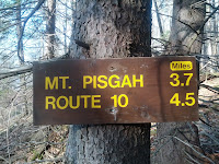
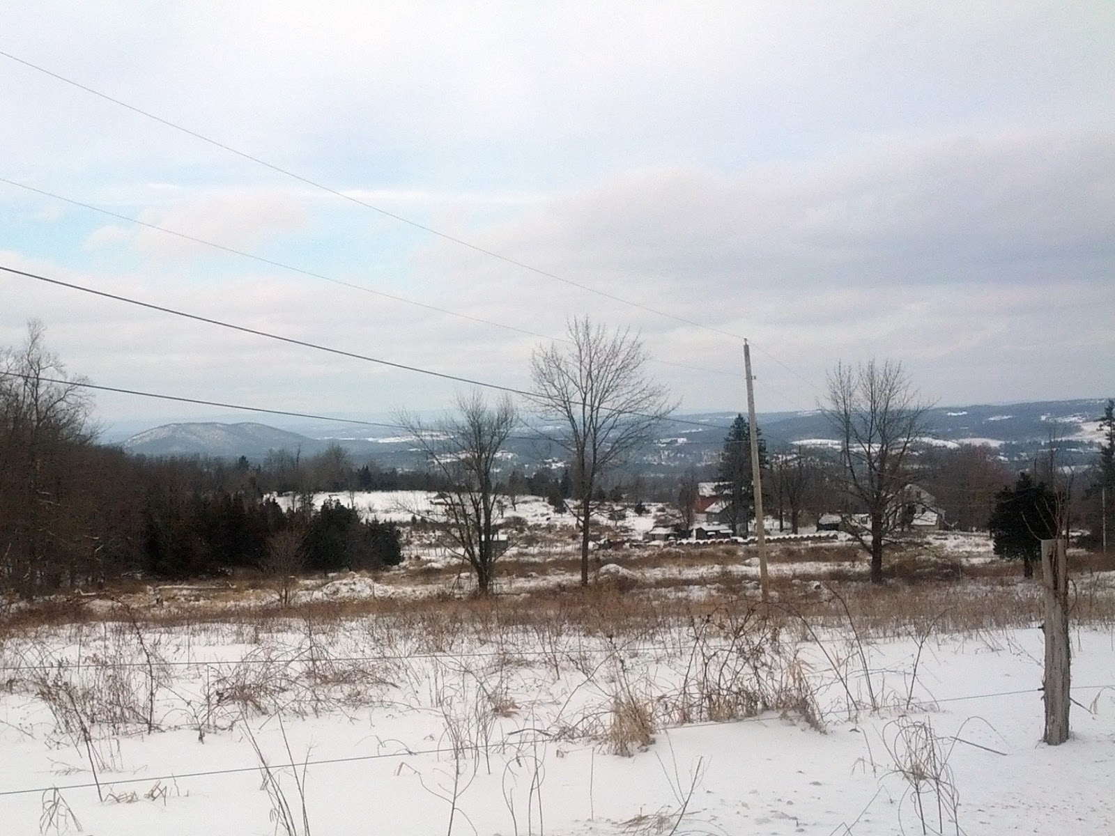
The trail started parallel to Rt. 23 and was easy and we joked about how nice it was to hike something easier than Blackhead and Windham (those two pretty much kicked my butt last time out). We hiked up Jennie Rd and a Beaver pond was on the left. The trail became very steep going up to Jennie Notch and we soon reached the summit of Ginseng Mountain. We walked down the backside, some views of the valley below were present, but it was a bit hazy to see all the way to the Adirondacks (I really hoped to see them because it would be a mental milestone proving how far we've walked this year). We soon walked up to Barlow Notch and Mt. Haydon. It was at a good clip and we expended a lot of energy on the climb which seemed more difficult than I thought they would be (based on the old trail profile on the conference website). After crossing Cunningham rd near the end of Section 24, we were walking along a logging road and I completely missed a trail marker and we had to double back a short distance to reconnect to the trail. We soon crossed Rt 10, and began section 25. This was the section that the trail guide mentions an overgrowth of brambles. This ended up not being an issue in the winter time. The next climb was initially along some scenic escarpment rock and it turned into a steep climb to the top of Mt Pisgah which required another big push of energy. I almost hate to admit it, but at this stage all I could think about was I did nothing over the last two weeks except say “yes” to every rich meal and beverage that came my way. I was now sweating off this bloated, sloshing, excessive lifestyle to the point that even my outer wear (a fleece lined hoodie) was completely soaking wet. I laughed about it because I knew there was another huge Christmas party right after the hike and with it I would immediately restart my cycle of excess.  Appetizer? Yes! More Wine? Why, yes of course!  Even more great holiday food?  Absolutely YES!
Top of Forest Rd.
Big miles today
We reach the summit of Pisgah and were immediately surrounded by a grove of beautiful pines here. We broke for lunch in the col between Pisgah and Richtmeyer Peak. Nearby, at the top of Richtmeyer, I was able to take some photos of the Blackhead range and the Devils Path beyond. We cleared a lot of deadwood branches from the trail as we plodded forward and made an effort to assist in maintaining the trail. Chris said only one maintainer was handling abut 45 miles, so we wanted to help in any way possible. Since no good deed goes unpunished, I later realized I lost my good pair of sunglasses somewhere on this section when clearing deadwood. Hopefully the next hiker is rewarded by finding them since it made no sense to expend the energy to backtrack and find them. We soon after came upon a woods road, which immediately dumped us into a majestic grove of towering Norway Spruce trees. It was a very healthy stand of trees and exited the bottom in the midst of a bubbling stream.


Clear cuts #2
Catskill Clear cuts
Forest Rd entrance (end of section 25)
We walked on a packed red dirt Bluebird forest road and exited to the right and into another pine grove. I decided I really love the pines on this hike and it was the best part of the day. The last section of the day was a steep uphill climb through a DEP section that was not very well thought out in terms of being a fun hike. It seemed to focus on the borders/boundary line of a few tracts of land and we simply were walking up the steep edge. I started uphill in long strides, and instantly twisted with a terrible cramp in my inner thigh. It actually brought me crashing down to the ground in withering pain as the muscle group completely knotted to the point of tearing.  Upon seeing my contorted face and how I was holding my leg, Chris suggested it was the abductor muscle (the one that has a special machine (leg spreader) in the gym dedicated to it). He reminded me with a hopeful smirk that I still had to walk out. We both know that even if hurt, you have to finish - no matter what. The cramp finally subsided and I shook it off.  I was ok to go on and just used shorter steps going up the hill. At the top of the hill we had to turn downhill on the forest road, which was cut through a grove of stellar pines. The road ended by the car a mile later.  We drove back over the mountain up Bluebird Rd.. Even though it was a dirt road it seemed well maintained. We saw clear cutting on the summit and tooks some photos. On the backside of the mountain facing Windham, there were beautiful dusk views of the Catskills.
Sunset to the south from Blueberry rd
Today’s hike was very scenic and most rewarding. I will admit I was also sore, cramped up and tired. We covered the 14.3 miles in about 6.5 hours, including breaks, so the pace was a bit fast for comfort but was the correct call. It gave us day light to cross the mountain on the dirt road and capture some incredible vistas to the North and South from the warmth of the car. I was so happy we did this one today. 
Trail Stats: 14.3 miles on the LP.
Current total:  While the end is clearly not in sight, we did complete 255 miles so far this year on the LP and accomplished something good. I hope to go again over the coming holidays for anyone interested in Section 26 and part of 27.

Link to Next LP Section: S Mountain Road to Mine Kill