The beautiful blue sky January morning gave me the signal to
hit the trail. But before getting to
that, I went to REI the previous evening to buy nylon gaiters and check out snowshoes. Snowshoes seemed expensive to me at first
glance ($130-$190) because they represent something that is completely
unnecessary in my life. Don’t get me
wrong, I learned last week I needed them to continue winter hiking in certain
snow conditions, I just mean they are unnecessary in a way because one can
always choose to do something different, like go skiing (which by the way represents
even more expensive gear that collects dust for more than 360 days a year in my
loft). Buying more sporting goods crap is actually a lifelong commitment to
store another piece of seldom used hardware for the rest of my life. Really not
a small commitment if you think about it on a higher level. I was spared from making a misinformed purchase
as soon as the sales clerk asked me a million questions about my height and weight,
my intended pack weight, heel movement preferences, whether I wanted ascent
angle adjustment, if I wanted a hiker type or mountaineering type shoe and
finally, whether I wanted the type I could add on a ski front and tail back pieces
to better handle all snow conditions. The guy was nice and I knew he was asking
the right set of questions, but I had that glazed over expression which told
him I was totally befuddled. He kindly informed me they will be having a clinic
on Tuesday to explain all this. I inwardly thanked him for giving me an excuse
not to buy one from him and moved to browsing other gadgets in the traction
control area. They also sold wicked looking spiked cramp-on’s ($90-$175),
micro-spikes (under $60) and spring like “yak” walkers ($25) that looked like a
terrible option for hiking but probably great for ice fishing or city walking. The bottom line, protecting your backside
from a fall can be pretty expensive considering you really need multiple pieces
of hardware to cover all possible conditions.
My current traction control consists of flexible rubber grips with little
replaceable golfer style cleats. These probably
score only about 2 out of a possible 10 for grip on ice but they would be fine today.
I pulled off Rt 94 into an unplowed AT parking area using my
4X4 to navigate the loose snow. One truck
was there already. The parking lot was clearly identified from the road but a 2
wheel drive vehicle would get stuck trying to get in or out. It reminded me how little attention the hiker
community gets from the local road departments.
The AT is a national park and I’ve yet to see any of the parking areas plowed
to allow year round access to it.
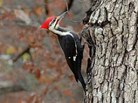 |
Pileated Woodpecker
(Photo from Wikipedia) |
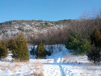 |
| Wawayanda Ridge |
I geared up with my little cleats and gaiters and hit the
snow. Fortunately, it was totally hard
packed on this part of the trail so there was no call for snowshoes here. The trail headed towards Wawayanda Mountain and
the Pinwheel Vista. My research prior on
the web typically uncovered the word “spectacular” as an adjective when
discussing this vista. After passing
through a snow field, the climb began and it was switchbacks up to the top
through a large boulder field with streams and large oak blow downs. I reached the top and a sign indicated the
vista was only 100 feet up a side trail.
Even though it was close, I decided to first complete the hike to
Barrett rd, then turn around and hike back to the vista for my lunch break. The trail became less packed after the side
trail so I realized 95% of the folks who come here never go further than the
vista trail. I was able to walk in
someone else’s prior footsteps so I was fine without snowshoes. I signed the
trail register at the top and move on gentle slope down. The leg to Barrett Rd. held that peaceful
easy feeling of being alone in the woods, with only the occasional sound and
sighting of a large Pileated Woodpecker hard at work. I crossed a bubbling brook and the small wood
bridge that was supposed to span the creek was tethered askew on one bank. It was easy to cross without it as it may
only be helpful in high water periods.
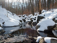 |
| Stream In Wawayanda |
Upon arriving at Barrett Rd, I decided to eat a few snacks
and dropped my pack to fetch them. A
couple (man & woman) were coming across the road in snowshoes to continue on
my side of the road. I waved politely to
them while they were approaching and I just happened to look down on the snow and
I saw evidence of fresh blood all over the place. I’m staring at the ground and thinking this like
a crazy “Larry David” moment. So here I
am by myself standing in an area of snow that is covered in large splats of red
blood while I am basically “laying in wait” to say hi to a couple of strangers.
My weapon of choice is my big mouth and
the damage it delivers is usually self-inflicted, so without real thought I simply
blurt out “Hi…” followed by “…look at all this blood here”. I didn’t see the woman’s face, but I suspect
every maternal instinct in her said “run”, except she was in snowshoes and I
wasn’t, which I’m sure caused her even more duress. The guy, being a regular dumb hiker guy like me, was immediately fascinated at the
blood and jumped into discussing the possible origins and we noted the lack of
drag marks if it was caused by a hunter pulling his catch. He thought the blood may be old, but I turned
over the snow a little with the tip of my pole and showed him it was bright red
and quite dripping, so we concluded it was very fresh and came from a real
bleeder. Awkwardly, I returned to hiking
talk and explained I was turning around here and hiking back to Rt 94 and he
said they were “continuing on in the same direct to Pinwheel vista” and “looked
forward to seeing it”. The snowshoes
“will help” I said, not knowing what else to say and decided to end the conversation with a sudden “goodbye” as I started
away from them. I realized moments
later, the woman never said a word the whole time, and I noted as I got further
and further away, that they never set out behind me in their intended direction. Hiking solo allows for all kinds of mental
contrivances to be played out in ones’ head, so after a few minutes I decided
she told her mate that she would follow behind me into the woods “over her dead
body”. I chuckled as I probably would
have done the same if the situation was reversed. After all, it was an unfortunate
meeting spot and I was “that strange guy” conspicuously waiting alone in an
area stained with fresh blood. You may
be asking “what’s the deal with the blood?” Good question, it’s one that occupied me for a
bit of the walk back to the vista and beyond.
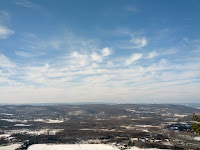 |
| The Pinwheel Vista |
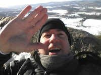 |
| "That Strange Guy" |
I arrived at the Pinwheel vista and it was worth the
wait. It really was a spectacular view. I could see the tower at High point along the
Kittatinny Ridge, the Mountain Creek ski area, and the Gunks to the north. I put
my space blanket on the snow in the leeward side of a rock and activated my MRE
lunch by adding the provided water into the package. I lay back against my pack and sat on a
cushion I always carry as insulation. For
once I was dry and warm in the sun and had no interest in moving off this spot. My MRE was sizzling hot in about 10 minutes.
It represents the very best in military self heating field rations, combining meat,
beans and noodles into something they called “Italian dinner”. I tasted it, hmm, not bad considering it’s a MRE,
but no self respecting Italian would ever serve this, so the name “Italian
dinner” was a stretch. Seriously, it was
good eats on the trail and warmed me up nicely inside and out. I stood for another 10 minutes just soaking
in the sun and the view before heading back to the car. I snapped a nice photo of the trail and a
tree in the field next to the AT. It was
a simple pleasure to be out on the trail today and look forward to the next
opportunity to hike again.
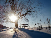 |
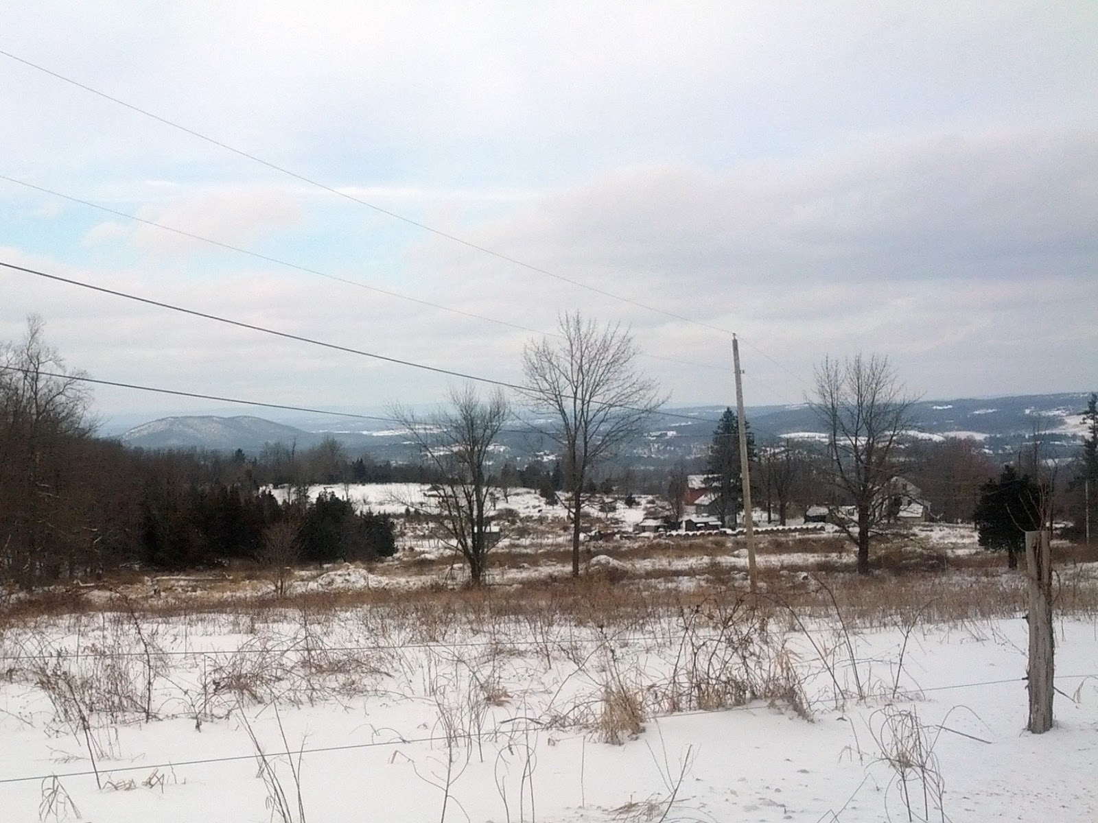
| Vernon Valley in Winter |
Trail Stats: 2.8
miles west on the AT. 5.6 hiked today