Sunday, January 6, 2013

The Snowshoe Detective - LP Bypass

LINK TO PREVIOUS LP-BYPASS SECTION ON AT: UPPER GREENWOOD LAKE TO BARRETT RD Wawayanda 

January 5, 2013

The beautiful blue sky January morning gave me the signal to hit the trail.  But before getting to that, I went to REI the previous evening to buy nylon gaiters and check out snowshoes.  Snowshoes seemed expensive to me at first glance ($130-$190) because they represent something that is completely unnecessary in my life.  Don’t get me wrong, I learned last week I needed them to continue winter hiking in certain snow conditions, I just mean they are unnecessary in a way because one can always choose to do something different, like go skiing (which by the way represents even more expensive gear that collects dust for more than 360 days a year in my loft). Buying more sporting goods crap is actually a lifelong commitment to store another piece of seldom used hardware for the rest of my life. Really not a small commitment if you think about it on a higher level.  I was spared from making a misinformed purchase as soon as the sales clerk asked me a million questions about my height and weight, my intended pack weight, heel movement preferences, whether I wanted ascent angle adjustment, if I wanted a hiker type or mountaineering type shoe and finally, whether I wanted the type I could add on a ski front and tail back pieces to better handle all snow conditions. The guy was nice and I knew he was asking the right set of questions, but I had that glazed over expression which told him I was totally befuddled. He kindly informed me they will be having a clinic on Tuesday to explain all this. I inwardly thanked him for giving me an excuse not to buy one from him and moved to browsing other gadgets in the traction control area. They also sold wicked looking spiked cramp-on’s ($90-$175), micro-spikes (under $60) and spring like “yak” walkers ($25) that looked like a terrible option for hiking but probably great for ice fishing or city walking.  The bottom line, protecting your backside from a fall can be pretty expensive considering you really need multiple pieces of hardware to cover all possible conditions.  My current traction control consists of flexible rubber grips with little replaceable golfer style cleats.  These probably score only about 2 out of a possible 10 for grip on ice but they would be fine today.

I pulled off Rt 94 into an unplowed AT parking area using my 4X4 to navigate the loose snow.  One truck was there already. The parking lot was clearly identified from the road but a 2 wheel drive vehicle would get stuck trying to get in or out.  It reminded me how little attention the hiker community gets from the local road departments.  The AT is a national park and I’ve yet to see any of the parking areas plowed to allow year round access to it.
Pileated Woodpecker
(Photo from Wikipedia)
Wawayanda Ridge
I geared up with my little cleats and gaiters and hit the snow.  Fortunately, it was totally hard packed on this part of the trail so there was no call for snowshoes here.  The trail headed towards Wawayanda Mountain and the Pinwheel Vista.  My research prior on the web typically uncovered the word “spectacular” as an adjective when discussing this vista.  After passing through a snow field, the climb began and it was switchbacks up to the top through a large boulder field with streams and large oak blow downs.  I reached the top and a sign indicated the vista was only 100 feet up a side trail.  Even though it was close, I decided to first complete the hike to Barrett rd, then turn around and hike back to the vista for my lunch break.  The trail became less packed after the side trail so I realized 95% of the folks who come here never go further than the vista trail.  I was able to walk in someone else’s prior footsteps so I was fine without snowshoes. I signed the trail register at the top and move on gentle slope down.  The leg to Barrett Rd. held that peaceful easy feeling of being alone in the woods, with only the occasional sound and sighting of a large Pileated Woodpecker hard at work.  I crossed a bubbling brook and the small wood bridge that was supposed to span the creek was tethered askew on one bank.  It was easy to cross without it as it may only be helpful in high water periods. 
Stream In Wawayanda
Upon arriving at Barrett Rd, I decided to eat a few snacks and dropped my pack to fetch them.  A couple (man & woman) were coming across the road in snowshoes to continue on my side of the road.  I waved politely to them while they were approaching and I just happened to look down on the snow and I saw evidence of fresh blood all over the place.  I’m staring at the ground and thinking this like a crazy “Larry David” moment.  So here I am by myself standing in an area of snow that is covered in large splats of red blood while I am basically “laying in wait” to say hi to a couple of strangers.  My weapon of choice is my big mouth and the damage it delivers is usually self-inflicted, so without real thought I simply blurt out “Hi…” followed by “…look at all this blood here”.  I didn’t see the woman’s face, but I suspect every maternal instinct in her said “run”, except she was in snowshoes and I wasn’t, which I’m sure caused her even more duress.  The guy, being a regular dumb hiker guy like me, was immediately fascinated at the blood and jumped into discussing the possible origins and we noted the lack of drag marks if it was caused by a hunter pulling his catch.  He thought the blood may be old, but I turned over the snow a little with the tip of my pole and showed him it was bright red and quite dripping, so we concluded it was very fresh and came from a real bleeder.  Awkwardly, I returned to hiking talk and explained I was turning around here and hiking back to Rt 94 and he said they were “continuing on in the same direct to Pinwheel vista” and “looked forward to seeing it”.  The snowshoes “will help” I said, not knowing what else to say and decided to end the conversation with a sudden “goodbye” as I started away from them.  I realized moments later, the woman never said a word the whole time, and I noted as I got further and further away, that they never set out behind me in their intended direction.  Hiking solo allows for all kinds of mental contrivances to be played out in ones’ head, so after a few minutes I decided she told her mate that she would follow behind me into the woods “over her dead body”.  I chuckled as I probably would have done the same if the situation was reversed. After all, it was an unfortunate meeting spot and I was “that strange guy” conspicuously waiting alone in an area stained with fresh blood.  You may be asking “what’s the deal with the blood?”  Good question, it’s one that occupied me for a bit of the walk back to the vista and beyond.
The Pinwheel Vista
"That Strange Guy"
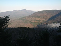
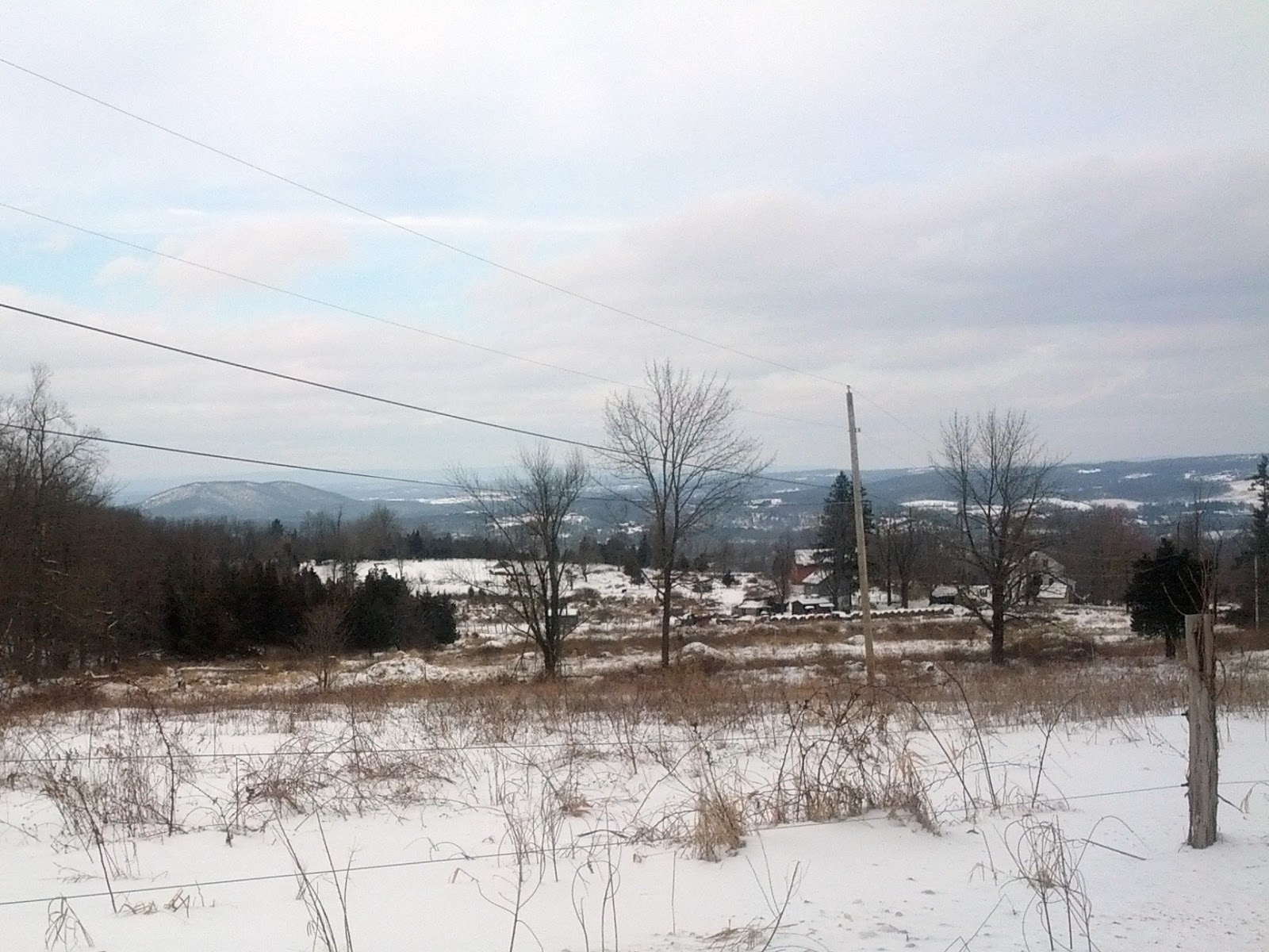
I arrived at the Pinwheel vista and it was worth the wait.  It really was a spectacular view.  I could see the tower at High point along the Kittatinny Ridge, the Mountain Creek ski area, and the Gunks to the north. I put my space blanket on the snow in the leeward side of a rock and activated my MRE lunch by adding the provided water into the package.  I lay back against my pack and sat on a cushion I always carry as insulation.  For once I was dry and warm in the sun and had no interest in moving off this spot.  My MRE was sizzling hot in about 10 minutes. It represents the very best in military self heating field rations, combining meat, beans and noodles into something they called “Italian dinner”.  I tasted it, hmm, not bad considering it’s a MRE, but no self respecting Italian would ever serve this, so the name “Italian dinner” was a stretch.  Seriously, it was good eats on the trail and warmed me up nicely inside and out.  I stood for another 10 minutes just soaking in the sun and the view before heading back to the car.  I snapped a nice photo of the trail and a tree in the field next to the AT.  It was a simple pleasure to be out on the trail today and look forward to the next opportunity to hike again.

Vernon Valley in Winter

Trail Stats: 2.8 miles west on the AT.  5.6 hiked today 

Tuesday, January 1, 2013

Following my footsteps - LP Bypass


LINK TO PREVIOUS LP-BYPASS SECTION: County Rd 5 to Upper Greenwood Lake
Winter on the AT.  Retracing my tracks
1/1/13  Happy New Year everyone!  I had hoped to do some more hiking up north over the holidays, but a few feet of snow dumped on the area north of Windham NY so I made the call to postpone things until better trekking conditions prevailed.  The snow was not my main concern as I’ve wanted to try snow shoeing this season and would have just bought a pair before going back upstate.  The issue was, the next leg was along a roadside, and I didn’t really want to be pinned into a road with high snow banks that wouldn’t allow me access to the shoulder.  I’ve already experienced the past thrill of diving into a snow bank to avoid being run over by a speeding and thoughtless driver (and that was right here in my own town in front of my house). 

Barrett Rd. Vernon NJ
Snow was deeper than I expected
I elected instead to return to the Appalachian Trail starting on Brady Rd. near upper Greenwood Lake.  This is the LP bypass route I mentioned a few times previously and is my local destination.   I arrived and found no parking area so I put the Jeep in four wheel drive and made my own space in the snow bank on the side of the road.  It was about 30F and a slight wind. The obvious depth of snow here told me my decision to avoid driving upstate to even deeper snow was the right call.  The trail was unbroken snow about a foot deep.  No one had hiked here in the short week since the snow fell.  I sank down 6 inches on every step and with each landing broke though some crusty under layer that jarred my knees. I hesitated committing to go on and thought it through in my head.   This would clearly be a pain in the ass (P.I.T.A.) to walk through all day.   I regretted not bringing (or buying) snow shoes prior.  The snow by my house was so low in comparison that it lulled me into believing the snow would not be so deep here in Sussex County.   Still, I ultimately convinced myself I didn’t need them - I was full of energy and enthusiasm to hike.  I plowed into the woods with my decision firm.  My plan was to hike the woods that crossed over Warwick Turnpike into Wawayanda Park and then cross the park to Barrett Rd.  This hike is only about 4 miles but I needed to turn around and retrace my step back to my car for another 4 miles.  The hiking was pretty difficult, but the terrain was easy compared to the Catskills. I found the progress of cutting the snow trail to be very slow going but my planned distance was perfect for a short winter day.  I stopped by the AT shelter on the trip back (called the Wawayanda Hilton) and took a nice rest there and greedily ate my lunch.  It was a sturdy structure with a privy nearby, a picnic table and a metal bear box to place your food into while you sleep.  The shelter was warmer than the outside, but it is not warm with the open front and holes in the floor between the beams.  I noted there is no fire is allowed here (ever), so I would choose a different shelter for a nightly camp over in cold weather (if possible).  I soon chilled out and had to move on to warm back up.

I trudged slowly back to the car and the round trip took over four hours.  I was very cold, soaking wet and surprising quite tired from the snowy effort.  I made a few New Year’s resolutions during my trip to get better gear.  One is to buy proper gaiters and pants that are more snow worthy than my soaked through cotton camo pants I usually hike in.  The second is to invest in snow shoes.  The difficulty of pushing forward in moderately deep snow for the eight miles without snow shoes resulted in more knee pain than I have ever experienced before, so it’s time to gear up.  I now look back and say it was a good outing in that I learned a lot and got decent exercise, but I learned enough to know I would never do it the same way again.

The map for this area is at:

Trail Stats: 4 miles more on LP-AT bypass.  8 miles hiking (round trip)

Footnote: 1/03/13  - its 2 days later and I must admit how sore my calves are still. Walking in snow and sinking with every step is called making a "posthole" or "postholing".    I made my share of postholes in one day. For those wanting pain, its really great "training", for all the others - Trust me - a true lesson learned. use snowshoes! 

LINK TO NEXT LP-BYPASS SECTION ON THE AT: WAWAYANDA TO VERNON VALLEY

Sunday, December 2, 2012

The Long "White" Path

The last bit of driving to Rt 23 at Windham was under winter conditions with plows out salting the road and pushing the 2 inches of snow off the road.  My friend Bob met Chris and I at the parking lot where the LP crossed Rt. 23 and the Escarpment trail ended.  Bob lives in the area and shuttled us to the beginning of our hike at Dutcher's Hollow trail head.  After seeing how far he drove us, he said we were crazy to do this in the snow.  We thought he may be right, but this was our opportunity to hike the 15 miles up and over Black Head and Windham high peaks prior to the full winter covering the area and making it near impossible to continue on until the spring melt.
We headed up the access trail and the snow covered rocks and made it slippery.  There was no ice, so the micro-spikes in my pack were not going to help here.  We soon passed two armed hunters that looked like mountain men with rifles.  They were looking for Bear.  Soon after we heard a shot ring out below. We wondered what they shot at, and hoped they were not aiming uphill. Next, we saw fresh paw prints, probably a bob cat.  We arrived at Dutcher Hollow and reconnected with the LP.  Chris was a bit anxious about Blackhead, especially the North side. The trail book describes it as:  "The Long Path drops precipitously down the north face of Blackhead, plunging over ledges in one of the steepest descents in the Catskills."  With most likely over 4 inches of fresh snow up there, we knew this would be tough day. Up we climbed and the snow did get deeper at the higher elevations.  Towards the top, I was pushing through 6 inches of fresh snow.  I wished I invested in "gators" because my pants and boots were getting cold and soaked.  It was suddenly colder up here, like in the mid 20's. We walked by four backpackers who camped the prior night just below the 3500' mark on a nice flat shoulder area.  
Chris on top of Blackhead Mt.
The surrounding pine trees were beautiful with fresh snow
We made the summit but there were no views due to the heavy fog. Next, we headed down the foggy abyss called the North side.  I was in the lead and relied heavily on my poles as we snaked down the steep cuts in a precipitous descent. We made it down the worst part, but soon after I tripped up with lost footing an fell headfirst in a crash down into several rock. Only my pride was hurt and Chris helped me up as I was unceremoniously lodged between the rocks.  He took the lead as I worked down behind him and nursed my bruised ego.  We continued down and still leaning heavily on the poles, I unexpectedly crashed again.  Chris kindly reminded me to use the poles downhill. I said I thought I did, and as I lifted my right pole we saw it was broken in half and useless.  My first fall must have damaged the pole, and it's collapse led to my second hard fall.  Chris tucked the pieces in my pack and we moved on, with me going slower on only one pole for support.  We soon past a group of day hikers going up the trail and we chatted about how "snotty" the trail was up slope, but it was easier going up than down.  We both breathed a sigh of relief when we finally got to the bottom saw the yellow-blazed Batavia Kill Trail to the left. I was pretty psyched up and it was a hell of an adventure getting up and down Blackhead in fresh snow.
We made it over Blackhead!
We continued on without a break and the trail began a gradual climb up an unnamed knob and then up to Acra Point. We reached the point and were only greeted with grey clouds.  This day would hold no views and it was a bit of disappointment we joked about.  We took 10 minutes and ate, in our only real break for the day. We descended to the col junction between Acra Point and Burnt Knob and we met a backpacker reading a map.  The next junction said 5.2 miles to rt 23.  We already hiked over 9.5 challenging miles and it was a bit tough pill to swallow another long climb up a few knobs and then up and down Windham high peak.  Up we climbed and I'll admit I took shorter and shorter steps just to kept the legs moving uphill. We finally reach the Windham high peak summit and we hardly said anything except we both were relieved to be here.  The day was getting late. The descent from Windham seemed tame in comparison to Blackhead with well designed switchbacks and easier grades.  A brief view to highland farmlands to the west opened up on one point and we snapped a photo.
The only view of the day
(to the west )
I ended up on my butt a few more times as having only one pole meant if I slid out on the other side, I was going down.  This happened more than I'd like to admit, but I got up, brushed off the snow and continued on down slope each time. The trail suddenly entered magnificent grove of Norway spruce trees. In the late hour it was dark and foreboding, our equivalent of entering the land of Mirkwood in the Hobbit. The roots were large and twisted and the trees were amazingly tall.  This is a place I would love to revisit on a warm sunny day. We soon cross Elm Ridge Trail and see a lean to sitting under the pine.  This is really a great spot to camp and was the best lean to location I have seen to date on the LP. With 1.2 miles to go, in fading light we continue the pace and soon make Rt 23 in relative silence.  It was five PM and we could just see the cars in the dark and we made it with no room for error.  We congratulated each other for doing it.  I honestly admired Chris's determination and expertise as this day was incredibly tough on us both and he pulled at the lead for a considerable portion of the day and never once fell. Finishing this escarpment section now is a big milestone with the all the Catskill high peaks behind us, and gives us the ability to continue this winter over the lesser mountains to the North.

Trail Stats: 14.8 miles total with 12.9 miles on LP.  

December 15, 2012
Mt Haydon / Nebo View to the Northeast
Today’s goal was to hike LP sections 24 and 25 and end at South Mountain Rd in Conesville NY after starting at Rt 23 junction near Windham. Chris met me at the end of Forest rd after we both navigated from East Durham and altered course after experiencing a “bridge out” detour on Bush Rd. We then shuttled back to the Rt. 23 trail head by 9:20 AM. With the relatively short day and cold weather, getting a 14.3 mile hike completed required an early departure from NJ. I now find myself driving about 260 mile round trip, including shuttles, to hike here for a day. It is clearly more difficult logistically than before, which is why we are both trying to get the most miles in when we can. The newest edition (2010?) of the Northern Catskill map set contains a detailed map of the LP over these mountains. Turn the main map over, it is located on the back side in a small area near the top. I thank our fearless guide Chris for pointing that out. This map is the only accurate guide now and the trail we will follow. All other maps are obsolete, but there is a trail conference written update here:

Chris - resting on summit of Pisgah
Mt Richtmeyer views to
Blackhead range
Along section 25
The trail started parallel to Rt. 23 and was easy and we joked about how nice it was to hike something easier than Blackhead and Windham (those two pretty much kicked my butt last time out). We hiked up Jennie Rd and a Beaver pond was on the left. The trail became very steep going up to Jennie Notch and we soon reached the summit of Ginseng Mountain. We walked down the backside, some views of the valley below were present, but it was a bit hazy to see all the way to the Adirondacks (I really hoped to see them because it would be a mental milestone proving how far we've walked this year). We soon walked up to Barlow Notch and Mt. Haydon. It was at a good clip and we expended a lot of energy on the climb which seemed more difficult than I thought they would be (based on the old trail profile on the conference website). After crossing Cunningham rd near the end of Section 24, we were walking along a logging road and I completely missed a trail marker and we had to double back a short distance to reconnect to the trail. We soon crossed Rt 10, and began section 25. This was the section that the trail guide mentions an overgrowth of brambles. This ended up not being an issue in the winter time. The next climb was initially along some scenic escarpment rock and it turned into a steep climb to the top of Mt Pisgah which required another big push of energy. I almost hate to admit it, but at this stage all I could think about was I did nothing over the last two weeks except say “yes” to every rich meal and beverage that came my way. I was now sweating off this bloated, sloshing, excessive lifestyle to the point that even my outer wear (a fleece lined hoodie) was completely soaking wet. I laughed about it because I knew there was another huge Christmas party right after the hike and with it I would immediately restart my cycle of excess.  Appetizer? Yes! More Wine? Why, yes of course!  Even more great holiday food?  Absolutely YES!
Top of Forest Rd.
Big miles today
We reach the summit of Pisgah and were immediately surrounded by a grove of beautiful pines here. We broke for lunch in the col between Pisgah and Richtmeyer Peak. Nearby, at the top of Richtmeyer, I was able to take some photos of the Blackhead range and the Devils Path beyond. We cleared a lot of deadwood branches from the trail as we plodded forward and made an effort to assist in maintaining the trail. Chris said only one maintainer was handling abut 45 miles, so we wanted to help in any way possible. Since no good deed goes unpunished, I later realized I lost my good pair of sunglasses somewhere on this section when clearing deadwood. Hopefully the next hiker is rewarded by finding them since it made no sense to expend the energy to backtrack and find them. We soon after came upon a woods road, which immediately dumped us into a majestic grove of towering Norway Spruce trees. It was a very healthy stand of trees and exited the bottom in the midst of a bubbling stream.


Clear cuts #2
Catskill Clear cuts
Forest Rd entrance (end of section 25)
We walked on a packed red dirt Bluebird forest road and exited to the right and into another pine grove. I decided I really love the pines on this hike and it was the best part of the day. The last section of the day was a steep uphill climb through a DEP section that was not very well thought out in terms of being a fun hike. It seemed to focus on the borders/boundary line of a few tracts of land and we simply were walking up the steep edge. I started uphill in long strides, and instantly twisted with a terrible cramp in my inner thigh. It actually brought me crashing down to the ground in withering pain as the muscle group completely knotted to the point of tearing.  Upon seeing my contorted face and how I was holding my leg, Chris suggested it was the abductor muscle (the one that has a special machine (leg spreader) in the gym dedicated to it). He reminded me with a hopeful smirk that I still had to walk out. We both know that even if hurt, you have to finish - no matter what. The cramp finally subsided and I shook it off.  I was ok to go on and just used shorter steps going up the hill. At the top of the hill we had to turn downhill on the forest road, which was cut through a grove of stellar pines. The road ended by the car a mile later.  We drove back over the mountain up Bluebird Rd.. Even though it was a dirt road it seemed well maintained. We saw clear cutting on the summit and tooks some photos. On the backside of the mountain facing Windham, there were beautiful dusk views of the Catskills.
Sunset to the south from Blueberry rd
Today’s hike was very scenic and most rewarding. I will admit I was also sore, cramped up and tired. We covered the 14.3 miles in about 6.5 hours, including breaks, so the pace was a bit fast for comfort but was the correct call. It gave us day light to cross the mountain on the dirt road and capture some incredible vistas to the North and South from the warmth of the car. I was so happy we did this one today. 
Trail Stats: 14.3 miles on the LP.
Current total:  While the end is clearly not in sight, we did complete 255 miles so far this year on the LP and accomplished something good. I hope to go again over the coming holidays for anyone interested in Section 26 and part of 27.

Link to Next LP Section: S Mountain Road to Mine Kill

Tuesday, November 6, 2012

The Devil is in the Details

LINK TO PREVIOUS SECTION: Mt. Tremper to Silver notch
October 26-27, 2012
Towards Silver Hollow (Hazy -from above)
View from Plateau Mt.:
Mink Hollow (down below the clouds),
Sugar Loaf (on right) and Kaaterskill High Peak
w/ Round Top (in distance).
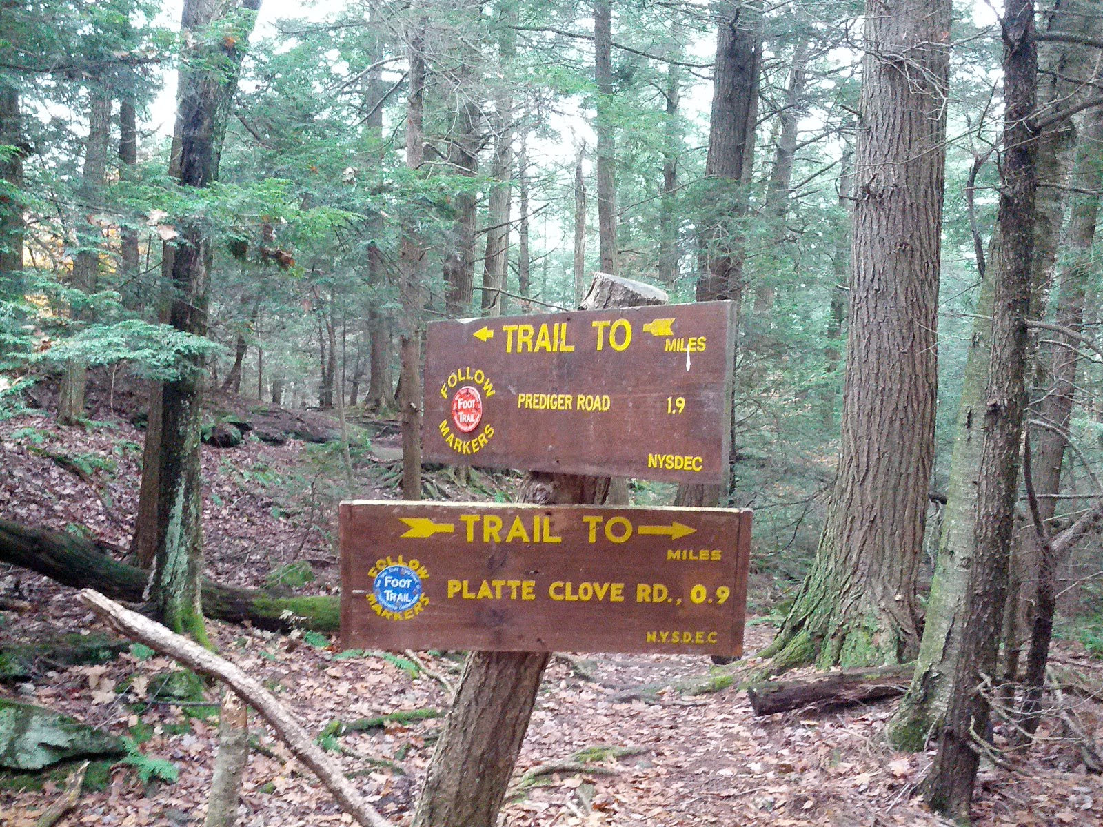
I had a business meeting in Kingston NY on Friday morning and decided to use the proximity to the Catskills to backpack hike from Silver Hollow notch to Platte cove road by camping at Mink Hollow. Chris decided to join in with Andrea and we placed a car by the Roaring Brook trail head and the other at parking area on RT 214 (just south of the access point to Notch Inn road). The plan was Andrea would hike with us on the LP to meet the Devil’s Path and then hike down Plateau Mountain to Mink Hollow shelter.  The next day, she would hike an easier route to the car and later pick us up at the trails end. Chris and I would then hike over Sugarloaf, Twin and Indian Head mountains, all over 3500' elevation. If you read the first paragraph on page 1 of the blog from January, I mentioned the Devils path. We would now be doing that same section in reverse with an overnight backpack.
Porcupine in Pine 
We started up the access trail along a private road, but by the time we got to the main trail at Silver notch, my back and head hurt because my pack was really setup badly and it was off balance.  Chris has good experience with packs and he showed me a few adjustment tricks that lowered the weight onto my hips and therefore relieved nearly all of the acute problems I was experiencing.  Feeling better, we began a long ascent towards Plateau.  I moved ahead (or lagged behind) as I listened to tunes and walked at my own pace. Along the way, they saw a porcupine on the trail that spread his quills like a peacock.  He eventually climbed a tree and allowed me to take a few close up photos.  I knew the quills were his main defense, but he actually becomes pretty camouflaged once in a tree and is actually hard to see (or photograph) once he stays still.

Plateau: LP - Devil Path jct.
Alpine flora
We connected up to the Devils path on top of Plateau Mountain. I was really happy to think that I walk all the way back here after hiking this area last year and thinking it was a great area.  The tops of the mountains here are really lush with alpine like pines and lichen. It is a really special environment above 3500’ up.  I can see why no camping is allowed up here.  It is a very sensitive region in the Catskills.  I took a few photos to capture the green and wet diversity.
Andrea and Chris - Initial Plateau descent
The descent down Plateau was quite challenging and slowed us all down. It was extremely wet and slick with mud and lichen.  I lost my footing once and “bam” down I went along a steep ten foot rock.  I picked up speed as I went and banged my hand, hip and elbow pretty hard in an uncontrolled slide before getting up and shaking it off.  
Plateau Mt.
 "Steep and Tough"- Mink Hollow side
It was deceivingly dangerous and suggested to the others to instead use the roots on the top and side and just stay off that rock.  I made it down the rest of the mountain without further incident and kept the other two behind me just within earshot (even if they didn’t know it at the time).  I decided not to push forward by myself as it was nearing dark and it is (usually) always best to keep a group together on the trail. The tough stuff finally gave way to forest and soon we were all at the Mink Hollow shelter.
I set up my hammock and tarp nearby the shelter. By now Andrea was completely spent and we gave her a loud ovation for making it here.  She got in her sleeping bag in one corner of the shelter and basically stayed there for the rest of the evening. Chris and I fetched water to the south and upon return I made a fire.  The shelter was just rebuilt and we had ample old and new cedar shakes and planks to burn.  Everything was really saturated, so it was hard to get it going, but I eventually it was coaxed into a good fire. It dried the shelter significantly and felt great.  By now it was pitch dark and the visibility was only about ten feet with headlamps as a wicked dripping fog settled in around us.  We saw another pair of headlamps making their way up Mink hollow and they soon introduced themselves as Audrey and Martin.  We directed them to a camp area and we saw Martin later in the evening as we hung the food using a bear bag.  [We saw them both again the next day and took some pictures.] 
Audrey and Martin at Mink Hollow
( Morning of the 27th)
After a great meal of bratwurst, potatoes and veggie stew, we toasted the world with a little rum in our tea and I decided to call it a night. I tucked into my hammock and listened to music and enjoyed the comfortable surroundings.  I made the hammock the night before from very lightweight nylon (1.2 oz / sq yd) and used two longer layers this time.  I put a thermal foam rest between the two layers as insulation and used a light down bag for warmth.  My silnylon tarp performed properly and shed the light rain and blocked the wind.  I hoped this would be an improved step up from the very cold and uncomfortable setup I used a few weeks back at Stockbridge.
Hammock with rip...
It got colder and I stayed warm (mostly) but I kept heard a tearing sound as I moved around here and there. I fully expected to crash to the ground at any moment.  I was woken once from the squeal of a Bard owl in the distance.  I was having trouble staying asleep.  I heard Chris and Andrea taking late into the night from over by the shelter and finally put earplugs in to drown them out. I woke up by hearing Chris say “time to get up” at a very late 8am.  I looked at the hammock to see what created the sound and the lower layer had split badly at the point where I cut it some to push in the insulation.  I decided it could be fixed later and thanked the stars I made it through the night.
I need to go lighter....
I found Chris making coffee and Andrea still in the same spot from the evening.  They mentioned they were up a bunch of the night because a “friendly” mouse kept getting into everything in the shelter.  It shredded some paper towels and got into a bag with chocolate. This is one of the reasons why I brought my own shelter. After cooking some breakfast burritos and packing up, we were off to the trail. Andrea left for the car and Chris and I went up Sugarloaf.  It was steep and I concentrated on my footing after the previous fall yesterday.  It heated up quickly and I took extra breaths and pauses as “Gravity was really Fierce” and I needed extra OOOOs (oxygen) to recover from the climbs.  We passed a day hiker going in the opposite direction and he introduced himself as Sean and mentioned he was doing the entire Devils path in a day.  Wow, I hope he made it!  That is a real challenge.
Stone Chair in abandoned blue stone quarry.
They called themselves "Low Expectations"
on summit of Twin Mt.  
We hit the summit and down we went toward Pecoy notch. One down, two to go…Next, Twin mt was exceedingly steep and wonderful to climb on the aptly named “Devils Path”. We found a good ‘ol boy group of three guys on the summit that called themselves “Low Expectations”.  We swapped gear and hammock stories and one offered up some Jack Daniels.  I took a small swig and it burned on the way down.  We crossed the mountain and down we also went.  The drop to Jimmy Dolan notch from Twin was pretty easy in comparison to the opposite side. Only Indian Head Mountain remained and we went up it smoothly.  The omnipresent fog and clouds prevented any view.  The descent down the mountain took ages as it was very slick and we crossed a few tough points.  I remembered most of this from last year and it brought back memories of how I did this my friends with ice and snow on the ground and the same sections we were doing today in six took nine hours then.
Finally down Indian Head Mt
(looking back)
Platte Cove Rd.  We made it.
Long Path and Devils Path Split
We came down at a good clip and Andrea was waiting right on time and we happily shuttled back to my car.  I ate pizza at Brios in Phoneticia NY and headed for home. Chris and Andrea stayed on another night in the area as Chris was doing trail construction the next day on Romer Mt.  I admire how so many people (like Chris, Andy and Jakob) selflessly spend their own time and money to build and maintain the trails many of us take for granted.
Trail Mileage: 13 on the LP (+ 0.75mi to access the trail).  No issues with knees, etc..good trip.
Footnote:  This trip was the weekend of hurricane Sandy, and I actually was writing it during the hurricane until power cut out and I didn't get to upload it.  It is now eight days later, and I’m still without power and am using a generator to boot this computer and get at the content.  So much destruction occurred to our region and I pray for everyone involved and know we can get through this together. 

November 11, 2012
Kaaterskill High Peak – Palenville

I did the 10 mile hike today from Platteclove Road to Rt 23A in Palenville with Chris.  It was a really nice fall day in the central Catskill Mountains, warm enough to only hike in base layers.  The overall distance did not seem long , the trail was very easy compared to the previous three outings, but very wet in certain places.  Chris mentioned the trail followed the fall line and it’s a better practice to construct a trail on an angle to the fall line to keep the trail dry and erosion free.  The first part of the hike climbs near Kaaterskill high peak on a snowmobile trail, but avoids the summit and therefore has no views.  It would have been an additional two mile roundtrip to the summit of this >3500’ peak, so we passed on that option.  After leaving the snow mobile trail, we saw some nice area to camp for those interested thru-hiking. They tended to be about 4 miles into the hike.  After a few hours we reached the scenic Buttermilk falls. There was a view of the Catskill Escarpment above and Kaaterskill Clove below and water cascaded off the cliff to the region below.  It was after Hurricane Sandy and some seriously large pine trees blocked the trail in this area and would require a big trail crew here to fix it.
Next we made Wildcat falls, a wonderful area to picnic with the water also cascading over the rocks.  Ice covered some areas (mostly in the shade) and we were pleasantly startled by the sound of a large ice piece being released off the cliffs below and then watched them tumbling down into the rocks.  The second part of the hike was a very long downhill and I’m happy to report that my knee pain was under control and conditioning (today defined as hiking over 250 rocky miles this year) has its benefits.  Once finally down the mountain, we ended up walking past houses on a road next to Kaaterskill creek, crossed an abandoned road section (an old mill area) and then finished with a brief road walk along rt 23A to the parking area. 
Quaint gingerbread trimmed house along the LP on Kaaterskill Creek
(For sale sign - quiet stream front location.)
Chris really wanted to climb another 4 miles to the escarpments to complete the next section and better position us for the next hike, but my schedule simply didn’t allow for an extra two hours.  I truly regretted having to pass on this extra bit, because my legs and my energy level were still in “go” mode and it would most likely now force us to do the Escarpment/Blackhead range in three sessions instead of two.  The trail access points on that large stretch of parkland are very limited.  I took a picture of a sign showing it was Rip Van Winkles home turf!
Trail Stats: 10.3 miles
Overall Long Path Progress:  218 miles done on main trail.  and about 25 miles on the AT-SRT bypass.

Nov 24, 2012

“Le Escarpment”

with Mauro at Artists Rock
After a really wonderful Thanksgiving meal with my family, I decided to use up all those extra holiday calories on the trail.  I found myself anticipating this stage all week because it was the beginning of the Long Path (LP) traverse of the very popular and scenic Catskills Escarpment trail.  Here, the LP covers a remote section of about 28 miles with no road crossings.  The Escarpment trail is 23.9 miles, but today we started well below it in Palenville and first needed to climb up to the North-South Lake area. (For those referring to the published LP sections, the full Section #21 is the 4.5 mile climb to the Escarpment and the next section #22continues over North Mountain and Blackhead Mountain.  The links are: http://www.nynjtc.org/files/Central%20Catskills21.pdf and http://www.nynjtc.org/files/Central%20Catskills22.pdf)

Praising Nature
on Boulder Rock
It was a briskly cold morning and the climb up to the escarpment was at a steady incline, designed originally for horse/carriage traffic up to some grand hotels positioned on the top edge. In many respects, this upper lake area is where recreational hiking became popularized in the Catskills. Artist Thomas Cole patiently created lasting masterpieces of the Catskills and Hudson valley below (particularly on Artist rock).

Ridiculous dumb etc...
Chris, Andrea and Mauro joined me today, but Andrea planned to exit at North-South lake while the rest of us continued over North Mountain. I climbed boulder rock and reached for the heavens, as it was a great day to be alive. It was also nice to travel again in view of the Hudson River below, as it was my long lost companion from the earlier Palisades sections.  It began snowing on top and we knew we made the correct decision not to try to cross Blackhead mountain on this day hike, considering an early November sunset was in the forecast. This is why I was a bit mad at myself last time for not pushing forward and getting to the top of the Escarpment and putting us in a better position here.  The former site of the Kaaterskill Hotel held an incredible view and was a popular tourist site. The trail continued up along the escarpment cliffs and many more excellent views abounded, even with the patchy snow fall.  I goofed around on artist rock as if I was hanging on a cliff (like some viral photo I saw the previous week of a girl hanging off the Grand Canyon).  Her photo was actually funny; mine was just fun to do.  We reached North point under heavy winds and whipping snow so the visibility was only fair, but I can see this is a great spot to picnic on a good day.  

Chris the Caveman
We instead ate lunch in Badman’s cave and it gave good protection from the snow and wind.  I used an MRE left over from hurricane Sandy and it was pretty tasty, but it took 12 minutes to heat.  Next time, I would prep it sooner during the walk and just carry it until ready.  I also found the heater in the kit had a second use as a hand warmer as we continued hiking into the freezing wind.  It was probably about 26oF (or lower at times with the wind chill) and my hands were numb in just my glove liners.  In fact, the water lines on the Camelbacks froze up so I admit I was not fully prepared for what the Catskills could deliver in the late fall season.  We came across a plane wreck on top of the mountain near Stoppel Point (about 3400’) and we paused to take it in and I climbed into the cockpit in the steady snowfall and Mauro took my picture.  I later learned the pilot died here and in hindsight, I should have been more respectful of the crash site considering all.  The pilot was John T Grace flying a Piper PA-28 (#N1316T). He crashed on the morning of May 25th 1983 from Poughkeepsie to Watertown, NY.  He had a revoked student pilot's license. He didn't file a flight plan. The info about the crash and a link to a 3D topo map and GPS waypoints of the plane was referenced at:  http://www.catskillmountaineer.com/NSL-stoppel.html.


We hiked down to Dutcher’s Notch on slippery snow covered rocks and each time one of us slipped, we teased each other with a emphatically dumb sounding “Hey Yooooooooo” (the sound Ed McMann did on the Johnny Carson show).  This somehow kept the mood high, even as the trail became more dangerous as the day wore on.
North Mt Ridge - Beginning of Snow
Mauro on North Point.
North -South lakes in distance
Distance from Dutcher to Black Head and Rt 23
We elected to hike 11.1 miles on the LP and take the right turn trail to parking 2 miles and 1700’ below down Dutcher Notch Trail to the first parking access (off Floyd Hawver Rd.)  [Our only other option was the longer 4 miles to Colgate Lake area to avoid the descent down the notch trail.]. This notch trail was ok with constant grade on an old road, frequently washed out and now very slick with snow on leaves and now some ice on the rocks.  My left knee was complaining and I requested a couple of 5 minute breaks here and there to stretch it out and recover.  This really helped and I was able to continue at a good pace. I appreciated the guys had to chill out and wait for me in the cold.  Andrea was waiting for us at the end with the car (Storks nest Rd. Parking) as we walked by an orange clad property owner with a loaded gun.  He was finished with deer hunting and fortunately we were not in his sights.  I also take this as a great opportunity to warn you not to park at the end by his driveway.  Chris fished out a couple of wonderful microbrew beers from the car cooler and we soon shuttled back to where it all began in Palenville.  Mauro and I headed off for home while the others were off to Phoenicia.  Mauro and I made a great decision to detour and have a meal at Two Brothers Tavern just off RT 32 in Saugerties. 

[Footnote The next section is back up Dutcher notch in a climb over 2800’ to the summit of Blackhead, continuing over Windham Mt and then finally to Rt 23 about 15 miles later.  After dealing with the snow today, I’m left wondering if we can pull this off before the snows lock it in for the season.  to be continued… ]

Trail Stats: 11.1 on LP, 13.1 miles on total. 

This is a great link to the trail map and description for the Escarpment trail: