Previously, Chris sent me a note that he had finished section 18 from Phoenicia to Silver Notch last weekend. He basically gave me forewarning that it was not to be taken lightly in cold weather. One has to climb over Tremper mt, cross Carl mt, descend Carl, wade across Warner brook with no bridge, climb Edgewood mt and finally hike down and out... I read the note as " I'm ahead of you, get in gear, tough one..". Chris did me favor and that is what this journey and blog is 100% about...keeping it real.
 |
| Fire Tower View |
 |
| Tremper Trail |
 |
| Fall wildflowers |
I was actually two sections behind him, so I brought my bike and met up with Jeff by the Tremper trail head and he rode with me to Woodland Valley in my car. I then rode back to Tremper as Jeff followed me in my car. It was 90% downhill so it was a true highlight to knock off about 6 miles of the LP in only about 15 minutes.
 |
| Fire Tower View |
We then shuttled a car up Rt 214 to Notch Inn rd, parked off road by a state forest sign, and headed back to the Tremper head trail in car #2. The property owners their clearly had signs in specific locations saying they would tow your car if park there, so I stayed far away from them where I parked.
 |
| Fire Tower View |
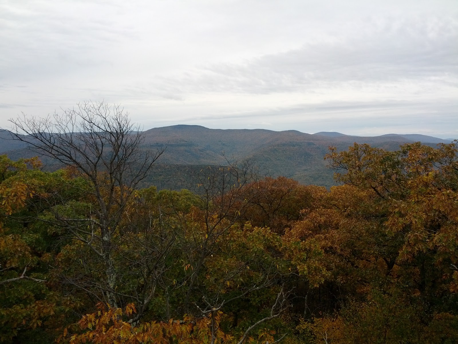
Jeff had loaned out his daypack to a family member and had an overloaded hip/fanny pack. It was off balance as it drooped low and backward and was slowing him down. He slung it over his shoulder instead and that helped. The trail up Tremper was a wide old fire road access to the fire tower on the summit. It was long and not very memorable. We stop in a shelter on the right side of the trail and found an old bicycle inner tube to use as a harness to better support Jeff's pack. There was a reliable spring water source to the left shortly thereafter. We reached the summit in just over an hour and I climbed to the top of the fire tower and took some pictures of the spectacular 360 degree panorama. I climbed down and changed my shirt with a spare layer from my pack as we went up the mountain too fast for comfort and I was soaked through and through. Soon after Jeff crossed over the mark he previously reached on the LP. He had been re-hiking the last bit to help me catch up to where he left off. He also posed for a picture at that spot and it's about the worst hiking pose ever and we laughed at how bad it was in real time.
 |
| Jeff finally crossing into new territory |

We walked around Carl mt and the descent to the north was down nicely designed switchbacks. We passed a large cascade waterfall as we made our way along this tributary to Warner creek. It was a long, but not too long descent. The forest was so beautiful here with golden and red leaves as the fall colors were the best in this section. I saw a really unusual white fungus growing on a tree. Zoom in on the pic and you will see a million little tendrils on the thing that looked like icicles. [tough question of the day. can anyone identify this thing?]
 |
| Beautiful Fall foliage |
 |
| Snow Cascade Tree Fungus |
 Warner creek was cold and I crossed it barefoot. I thought about that guy Cody on the dual survivor show who always walks barefoot, even in cold conditions. My feet were so cold in minutes that I have no idea how he can do this and not suffer hypothermia. By the time I was sitting and getting my shoes back on, my inner thighs were cramping up badly from the tough hike prior and the cold shock to my legs. It was really wet and cold here so we kept walking to find a better area to break for lunch. I warmed up a Dinty Moore stew over a sterno. Hmmm, tasted really good, I was actually surprise as I never tried this before. We began ascending Edgewood mt and it seemed it would never end. It was tough as we were both tired in the legs at this point. In all, we climbed about a mile vertical today by the time we summited Edgewood. Soon into the final descent, Jeffs right knee was seriously hurting him (Defcom 9 pain level) and we stopped to attend to itn. I restocked the first aid kit that morning with some Aleive's for general pain and also some opiates (in case of very serious injury). He had to drive home later, so we decided that later option would be too strong to safely drive after. He was in considerable pain and I felt bad as hiking is not supposed to be grueling. I advise Jeff to finely chew two Aleive for more immediate absorption (hey, it's what I do in similar cases). We went down very slowly at that point and he even stepped down backwards on the steeper stuff as his knee was shot for the day. By the time we got to Silver Notch he was in better shape and the trail leveled out enough to be kind to us.
 |
| Silver Notch Sign |
I saw the sign for the Devils Path and was excited as this is the section I did almost exactly one year ago that planted the seed to actually hike the entire long path. I found it encouraging to think that I walked all the way back here from Jersey in day hikes over the last 9 months. We exited the LP and walked down Notch Inn path to the car (that happily wasn't towed). As a footnote, the LP has been rerouted here to now go over Plateau Mt instead of dropping down the notch trail and along Rt 214 to the Devils Tombstone Camp. We will need to refer to the trail conference website for the next section directions. I will be doing this on October 26 and 27 if anyone is interested in a backpack overnight.
Trail Stats:
6 miles on Bike, ~10.5 Miles by foot on LP, ~1 mile hike out to car.
LINK TO NEXT ENTRY - The Devils Path to Plattclove Rd.
LINK TO NEXT ENTRY - The Devils Path to Plattclove Rd.
No comments:
Post a Comment