October 26-27, 2012
 |
| Towards Silver Hollow (Hazy -from above) |
 |
| View from Plateau Mt.: Mink Hollow (down below the clouds), Sugar Loaf (on right) and Kaaterskill High Peak w/ Round Top (in distance). |
I had a business
meeting in Kingston NY on Friday morning and decided to use the proximity to
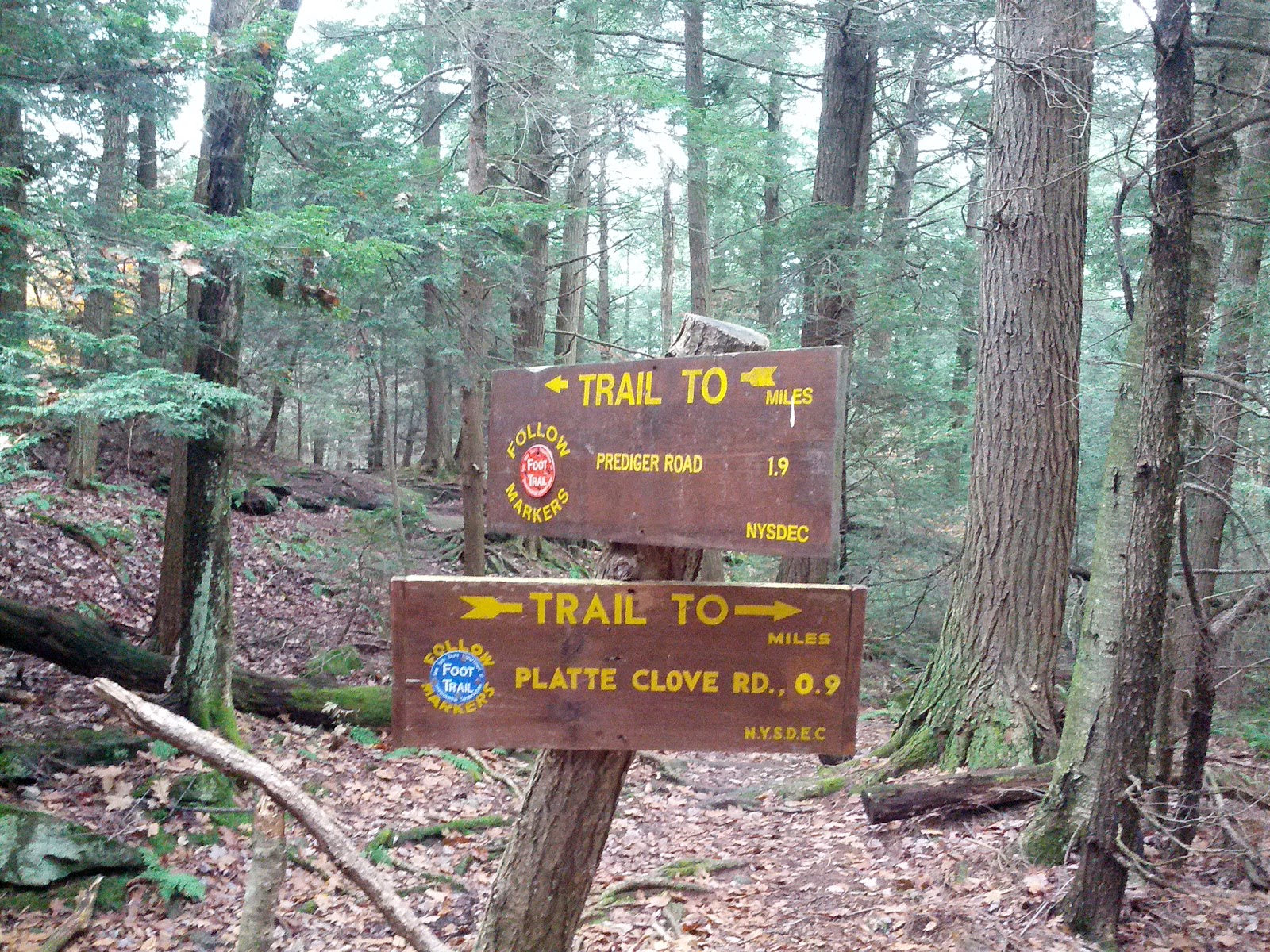
the Catskills to backpack hike from Silver Hollow notch to Platte cove road by camping
at Mink Hollow. Chris decided to join in with Andrea and we placed a car by the
Roaring Brook trail head and the other at parking area on RT 214 (just south of
the access point to Notch Inn road). The plan was Andrea would hike with us on
the LP to meet the Devil’s Path and then hike down Plateau Mountain to Mink
Hollow shelter. The next day, she would
hike an easier route to the car and later pick us up at the trails end. Chris
and I would then hike over Sugarloaf, Twin and Indian Head mountains, all over
3500' elevation. If you read the first paragraph on page 1 of the blog from
January, I mentioned the Devils path. We would now be doing that same section
in reverse with an overnight backpack.
 |
| Porcupine in Pine |
We started up the access trail along
a private road, but by the time we got to the main trail at Silver notch, my
back and head hurt because my pack was really setup badly and it was off
balance. Chris has good experience with
packs and he showed me a few adjustment tricks that lowered the weight onto my
hips and therefore relieved nearly all of the acute problems I was
experiencing. Feeling better, we began a
long ascent towards Plateau. I moved
ahead (or lagged behind) as I listened to tunes and walked at my own pace.
Along the way, they saw a porcupine on the trail that spread his quills like a
peacock. He eventually climbed a tree
and allowed me to take a few close up photos.
I knew the quills were his main defense, but he actually becomes pretty
camouflaged once in a tree and is actually hard to see (or photograph) once he
stays still.
 |
| Plateau: LP - Devil Path jct. |
 |
| Alpine flora |
 We connected up to the
Devils path on top of Plateau Mountain. I was really happy to think that I walk
all the way back here after hiking this area last year and thinking it was a
great area. The tops of the mountains
here are really lush with alpine like pines and lichen. It is a really special environment above 3500’ up. I can see why no camping is allowed up here. It is a very sensitive region in the Catskills. I took a few photos to capture the green and wet diversity.
We connected up to the
Devils path on top of Plateau Mountain. I was really happy to think that I walk
all the way back here after hiking this area last year and thinking it was a
great area. The tops of the mountains
here are really lush with alpine like pines and lichen. It is a really special environment above 3500’ up. I can see why no camping is allowed up here. It is a very sensitive region in the Catskills. I took a few photos to capture the green and wet diversity.
 |
| Andrea and Chris - Initial Plateau descent |
The descent down
Plateau was quite challenging and slowed us all down. It was extremely wet and
slick with mud and lichen. I lost my
footing once and “bam” down I went along a steep ten foot rock. I picked up speed as I went and banged my hand,
hip and elbow pretty hard in an uncontrolled slide before getting up and shaking
it off.
 |
| Plateau Mt. "Steep and Tough"- Mink Hollow side |
It was deceivingly dangerous and
suggested to the others to instead use the roots on the top and side and just stay
off that rock. I made it down the rest of
the mountain without further incident and kept the other two behind me just within
earshot (even if they didn’t know it at the time). I decided not to push forward by myself as it
was nearing dark and it is (usually) always best to keep a group together on
the trail. The tough stuff finally gave way to forest and soon we were all at
the Mink Hollow shelter.
I set up my hammock and
tarp nearby the shelter. By now Andrea was completely spent and we gave her a loud ovation for
making it here. She got in her sleeping
bag in one corner of the shelter and basically stayed there for the rest of the
evening. Chris and I fetched water to the south and upon return I made a
fire. The shelter was just rebuilt and
we had ample old and new cedar shakes and planks to burn. Everything was really saturated, so it was
hard to get it going, but I eventually it was coaxed into a good fire. It dried
the shelter significantly and felt great.
By now it was pitch dark and the visibility was only about ten feet with
headlamps as a wicked dripping fog settled in around us. We saw another pair of headlamps making their way
up Mink hollow and they soon introduced themselves as Audrey and Martin. We directed them to a camp area and we saw Martin
later in the evening as we hung the food using a bear bag. [We saw them both again the next day and took
some pictures.]
 |
| Audrey and Martin at Mink Hollow ( Morning of the 27th) |
After a great meal of
bratwurst, potatoes and veggie stew, we toasted the world with a little rum in our
tea and I decided to call it a night. I tucked into my hammock and listened to music
and enjoyed the comfortable surroundings.
I made the hammock the night before from very lightweight nylon (1.2 oz
/ sq yd) and used two longer layers this time.
I put a thermal foam rest between the two layers as insulation and used
a light down bag for warmth. My silnylon
tarp performed properly and shed the light rain and blocked the wind. I hoped this would be an improved step up from
the very cold and uncomfortable setup I used a few weeks back at Stockbridge.
 |
| Hammock with rip... |
It got colder and I
stayed warm (mostly) but I kept heard a tearing sound as I moved around here
and there. I fully expected to crash to the ground at any moment. I was woken once from the squeal of a Bard
owl in the distance. I was having
trouble staying asleep. I heard Chris
and Andrea taking late into the night from over by the shelter and finally put
earplugs in to drown them out. I woke up by hearing Chris say “time to get up”
at a very late 8am. I looked at the
hammock to see what created the sound and the lower layer had split badly at
the point where I cut it some to push in the insulation. I decided it could be fixed later and thanked
the stars I made it through the night.
 |
| I need to go lighter.... |
I found Chris making
coffee and Andrea still in the same spot from the evening. They mentioned they were up a bunch of the
night because a “friendly” mouse kept getting into everything in the
shelter. It shredded some paper towels
and got into a bag with chocolate. This is one of the reasons why I brought my
own shelter. After cooking some breakfast burritos and packing up, we were off
to the trail. Andrea left for the car and Chris and I went up Sugarloaf. It was steep and I concentrated on my footing
after the previous fall yesterday. It
heated up quickly and I took extra breaths and pauses as “Gravity was really Fierce”
and I needed extra OOOOs (oxygen) to recover from the climbs. We passed a day hiker going in the opposite
direction and he introduced himself as Sean and mentioned he was doing the
entire Devils path in a day. Wow, I hope
he made it! That is a real challenge.
 |
| Stone Chair in abandoned blue stone quarry. |
 |
| They called themselves "Low Expectations" on summit of Twin Mt. |
We hit the summit and
down we went toward Pecoy notch. One down, two to go…Next, Twin mt was
exceedingly steep and wonderful to climb on the aptly named “Devils Path”. We
found a good ‘ol boy group of three guys on the summit that called themselves
“Low Expectations”. We swapped gear and
hammock stories and one offered up some Jack Daniels. I took a small swig and it burned on the way
down. We crossed the mountain and down
we also went. The drop to Jimmy Dolan
notch from Twin was pretty easy in comparison to the opposite side. Only Indian
Head Mountain remained and we went up it smoothly. The omnipresent fog and clouds prevented any
view. The descent down the mountain took
ages as it was very slick and we crossed a few tough points. I remembered most of this from last year and
it brought back memories of how I did this my friends with ice and snow on the
ground and the same sections we were doing today in six took nine hours then.
 |
| Finally down Indian Head Mt (looking back) |
 |
| Platte Cove Rd. We made it. |
 |
| Long Path and Devils Path Split |
We came down at a good
clip and Andrea was waiting right on time and we happily shuttled back to my
car. I ate pizza at Brios in Phoneticia NY
and headed for home. Chris and Andrea stayed on another night in the area as
Chris was doing trail construction the next day on Romer Mt. I admire how so many people (like Chris, Andy
and Jakob) selflessly spend their own time and money to build and maintain the
trails many of us take for granted.
Trail Mileage: 13 on the
LP (+ 0.75mi to access the trail). No
issues with knees, etc..good trip.
Footnote: This trip was the weekend of hurricane Sandy,
and I actually was writing it during the hurricane until power cut out and I didn't get to upload it. It
is now eight days later, and I’m still without power and am using a generator to boot
this computer and get at the content. So much destruction occurred to our region and I pray for everyone
involved and know we can get through this together.
November 11, 2012
Kaaterskill High Peak – Palenville
 I did the 10 mile hike today from Platteclove Road to Rt 23A
in Palenville with Chris. It was a
really nice fall day in the central Catskill Mountains, warm enough to only
hike in base layers. The overall distance
did not seem long , the trail was very easy compared to the previous three
outings, but very wet in certain places.
Chris mentioned the trail followed the fall line and it’s a better
practice to construct a trail on an angle to the fall line to keep the trail
dry and erosion free. The first part of
the hike climbs near Kaaterskill high peak on a snowmobile trail, but avoids
the summit and therefore has no views.
It would have been an additional two mile roundtrip to the summit of this
>3500’ peak, so we passed on that option.
After leaving the snow mobile trail, we saw some nice area to camp for
those interested thru-hiking. They tended to be about 4 miles into the
hike. After a few hours we reached the
scenic Buttermilk falls. There was a view of the Catskill Escarpment above and
Kaaterskill Clove below and water cascaded off the cliff to the region below. It was after Hurricane Sandy and some
seriously large pine trees blocked the trail in this area and would require a big
trail crew here to fix it.
I did the 10 mile hike today from Platteclove Road to Rt 23A
in Palenville with Chris. It was a
really nice fall day in the central Catskill Mountains, warm enough to only
hike in base layers. The overall distance
did not seem long , the trail was very easy compared to the previous three
outings, but very wet in certain places.
Chris mentioned the trail followed the fall line and it’s a better
practice to construct a trail on an angle to the fall line to keep the trail
dry and erosion free. The first part of
the hike climbs near Kaaterskill high peak on a snowmobile trail, but avoids
the summit and therefore has no views.
It would have been an additional two mile roundtrip to the summit of this
>3500’ peak, so we passed on that option.
After leaving the snow mobile trail, we saw some nice area to camp for
those interested thru-hiking. They tended to be about 4 miles into the
hike. After a few hours we reached the
scenic Buttermilk falls. There was a view of the Catskill Escarpment above and
Kaaterskill Clove below and water cascaded off the cliff to the region below. It was after Hurricane Sandy and some
seriously large pine trees blocked the trail in this area and would require a big
trail crew here to fix it.
Next we made Wildcat
falls, a wonderful area to picnic with the water also cascading over the rocks. Ice covered some areas (mostly in the shade)
and we were pleasantly startled by the sound of a large ice piece being
released off the cliffs below and then watched them tumbling down into the
rocks. The second part of the hike was a
very long downhill and I’m happy to report that my knee pain was under control
and conditioning (today defined as hiking over 250 rocky miles this year) has its
benefits. Once finally down the
mountain, we ended up walking past houses on a road next to Kaaterskill creek, crossed
an abandoned road section (an old mill area) and then finished with a brief
road walk along rt 23A to the parking area.
 |
| Quaint gingerbread trimmed house along the LP on Kaaterskill Creek (For sale sign - quiet stream front location.) |
Trail Stats: 10.3 miles
Overall Long Path Progress: 218 miles done on main trail. and about 25 miles on the AT-SRT bypass.
Nov 24, 2012
“Le Escarpment”
 |
| with Mauro at Artists Rock |
After a really wonderful Thanksgiving meal with my family, I
decided to use up all those extra holiday calories on the trail. I found myself anticipating this stage all
week because it was the beginning of the Long Path (LP) traverse of the very
popular and scenic Catskills Escarpment trail.
Here, the LP covers a remote section of about 28 miles with no road
crossings. The Escarpment trail is 23.9
miles, but today we started well below it in Palenville and first needed to
climb up to the North-South Lake area. (For those referring to the published LP
sections, the full Section #21 is the 4.5 mile climb to the Escarpment and the next
section #22continues over North Mountain and Blackhead Mountain. The links are: http://www.nynjtc.org/files/Central%20Catskills21.pdf and http://www.nynjtc.org/files/Central%20Catskills22.pdf)
 |
| Praising Nature on Boulder Rock |
It was a briskly cold morning and the climb up to the
escarpment was at a steady incline, designed originally for horse/carriage traffic
up to some grand hotels positioned on the top edge. In many respects, this upper
lake area is where recreational hiking became popularized in the Catskills. Artist
Thomas Cole patiently created lasting masterpieces of the Catskills and Hudson
valley below (particularly on Artist rock).
 |
| Ridiculous dumb etc... |
Chris, Andrea and Mauro joined me today, but Andrea planned
to exit at North-South lake while the rest of us continued over North Mountain.
I climbed boulder rock and reached for the heavens, as it was a great day to be
alive. It was also nice to travel again in view of the Hudson River below, as
it was my long lost companion from the earlier Palisades sections. It began snowing on top and we knew we made
the correct decision not to try to cross Blackhead mountain on this day hike,
considering an early November sunset was in the forecast. This is why I was a bit
mad at myself last time for not pushing forward and getting to the top of the
Escarpment and putting us in a better position here. The former site of the Kaaterskill Hotel held
an incredible view and was a popular tourist site. The trail continued up along
the escarpment cliffs and many more excellent views abounded, even with the
patchy snow fall. I goofed around on
artist rock as if I was hanging on a cliff (like some viral photo I saw the
previous week of a girl hanging off the Grand Canyon). Her photo was actually funny; mine was just
fun to do. We reached North point under
heavy winds and whipping snow so the visibility was only fair, but I can see
this is a great spot to picnic on a good day.
 |
| Chris the Caveman |
We instead ate lunch in Badman’s cave and it gave good protection from
the snow and wind. I used an MRE left
over from hurricane Sandy and it was pretty tasty, but it took 12 minutes to
heat. Next time, I would prep it sooner
during the walk and just carry it until ready.
I also found the heater in the kit had a second use as a hand warmer as
we continued hiking into the freezing wind.
It was probably about 26oF (or lower at times with the wind
chill) and my hands were numb in just my glove liners. In fact, the water lines on the Camelbacks
froze up so I admit I was not fully prepared for what the Catskills could
deliver in the late fall season. We came
across a plane wreck on top of the mountain near Stoppel Point (about 3400’) and
we paused to take it in and I climbed into the cockpit in the steady snowfall
and Mauro took my picture. I later
learned the pilot died here and in hindsight, I should have been more
respectful of the crash site considering all.
The pilot was John T Grace flying a Piper PA-28 (#N1316T). He crashed on
the morning of May 25th 1983 from Poughkeepsie to Watertown, NY. He had a revoked student pilot's license. He
didn't file a flight plan. The info about the crash and a link to a 3D topo map
and GPS waypoints of the plane was referenced at: http://www.catskillmountaineer.com/NSL-stoppel.html.
 |
We hiked down to
Dutcher’s Notch on slippery snow covered rocks and each time one of us slipped,
we teased each other with a emphatically dumb sounding “Hey Yooooooooo” (the
sound Ed McMann did on the Johnny Carson show).
This somehow kept the mood high, even as the trail became more dangerous
as the day wore on.
 |
| North Mt Ridge - Beginning of Snow |
 |
| Mauro on North Point. North -South lakes in distance |
 |
| Distance from Dutcher to Black Head and Rt 23 |
We elected to hike 11.1 miles on the LP and take the right
turn trail to parking 2 miles and 1700’ below down Dutcher Notch Trail to the
first parking access (off Floyd Hawver Rd.)
[Our only other option was the longer 4 miles to Colgate Lake area to avoid
the descent down the notch trail.]. This notch trail was ok with constant grade
on an old road, frequently washed out and now very slick with snow on leaves
and now some ice on the rocks. My left
knee was complaining and I requested a couple of 5 minute breaks here and there
to stretch it out and recover. This
really helped and I was able to continue at a good pace. I appreciated the guys
had to chill out and wait for me in the cold.
Andrea was waiting for us at the end with the car (Storks nest Rd.
Parking) as we walked by an orange clad property owner with a loaded gun. He was finished with deer hunting and fortunately
we were not in his sights. I also take
this as a great opportunity to warn you not to park at the end by his
driveway. Chris fished out a couple of
wonderful microbrew beers from the car cooler and we soon shuttled back to
where it all began in Palenville. Mauro
and I headed off for home while the others were off to Phoenicia. Mauro and I made a great decision to detour
and have a meal at Two Brothers Tavern just off RT 32 in Saugerties.

[Footnote The next section is back up Dutcher notch in a climb over 2800’ to the summit of Blackhead, continuing over Windham Mt and then finally to Rt 23 about 15 miles later. After dealing with the snow today, I’m left wondering if we can pull this off before the snows lock it in for the season. to be continued… ]
Trail Stats: 11.1 on LP, 13.1 miles on total.
This is a great link to the trail map and description for
the Escarpment trail:
Hi I'm the Sean you met heading over Sugarloaf during this hike. Sounds like you guys a fun overnight out there! I did manage to do the Devil's Path that day (15 hours of fun) and posted a trip report over on ADKHighPeaks.com ( http://www.adkhighpeaks.com/forums/showthread.php?t=19532 ). Hopefully I'll run into you guys again up there!
ReplyDeleteSean, Thanks for getting in touch. Glad you knocked it out. I will go to your entry and read about it next. [We are doing the next 10 mile section sunday morning if [anyone is] interested in going.]
ReplyDelete