Saturday, October 13, 2012

Tremper to Silver Notch

Previously, Chris sent me a note that he had finished section 18 from Phoenicia to Silver Notch  last weekend. He basically gave me forewarning that it was not to be taken lightly in cold weather. One has to climb over Tremper mt, cross Carl mt, descend Carl, wade across Warner brook with no bridge, climb Edgewood mt and finally hike down and out...  I read the note as " I'm ahead of you, get in gear, tough one..". Chris did me favor and that is what this journey and blog is 100% about...keeping it real.


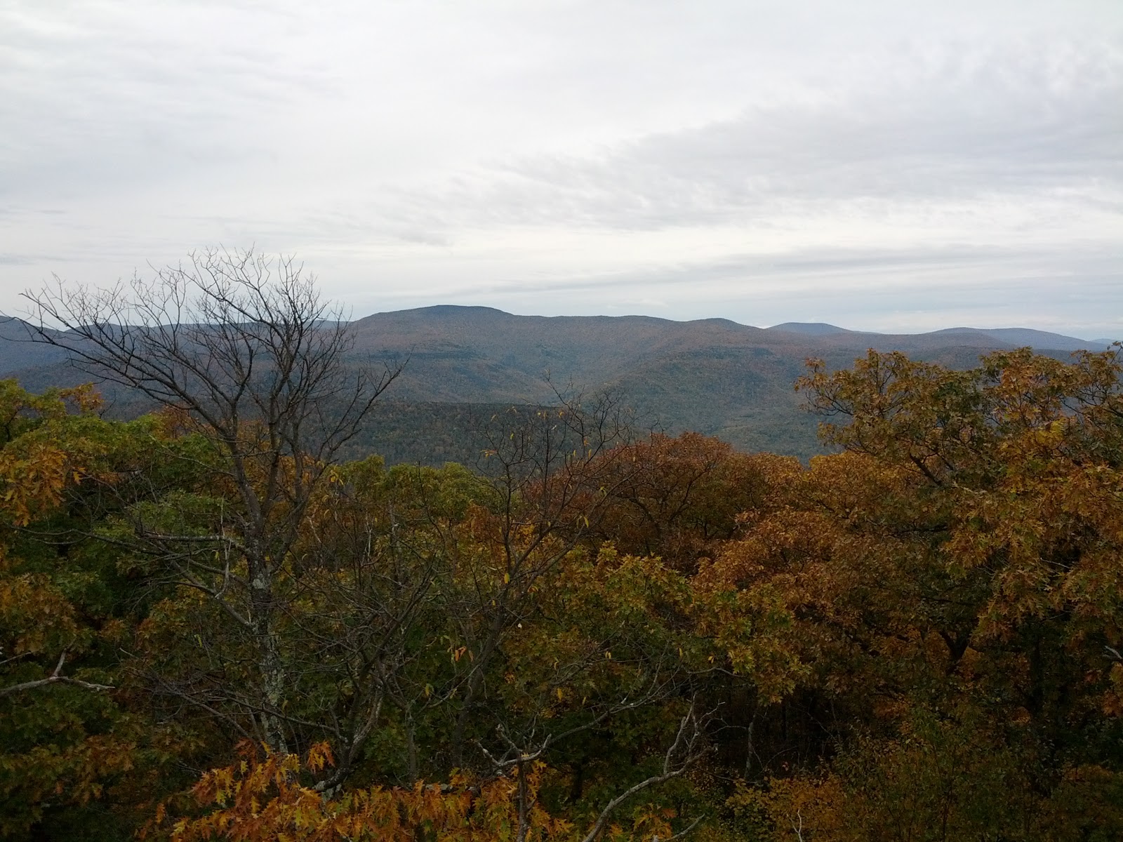
Fire Tower View
Tremper Trail
Fall wildflowers

I was actually two sections behind him, so I brought my bike and met up with Jeff by the Tremper trail head and he rode with me to Woodland Valley in my car. I then rode back to Tremper as Jeff followed me in my car. It was 90% downhill so it was a true highlight to knock off about 6  miles of the LP in only about 15 minutes.

Fire Tower View
We then shuttled a car up Rt 214 to Notch Inn rd, parked off road by a state forest sign, and headed back to the Tremper  head  trail in car #2. The property owners their clearly had signs in specific locations saying they would tow your car if park there, so I stayed far away from them where I parked.  

Fire Tower View
Jeff had loaned out his daypack to a family member and had an overloaded hip/fanny pack. It was off balance as it drooped low and backward and was slowing him down. He slung it over his shoulder instead and that helped.  The trail up Tremper was a wide old fire road access to the fire tower on the summit. It was long and not very memorable. We stop in a shelter on the right side of the trail and found an old bicycle inner tube to use as a harness to better support Jeff's pack. There was a reliable spring water source to the left shortly thereafter. We reached the summit in just over an hour and I climbed to the top of the fire tower and took some pictures of the spectacular 360 degree panorama.  I climbed down and changed my shirt with a spare layer from my pack as we went up the mountain too fast for comfort and I was soaked through and through.  Soon after Jeff crossed over the mark he previously reached on the LP.  He had been re-hiking the last bit to help me catch up to where he left off.  He also posed for a picture at that spot and it's about the worst hiking pose ever and we laughed at how bad it was in real time.
Jeff finally crossing into new territory
We walked around Carl mt and the descent to the north was down nicely designed switchbacks. We passed a large cascade waterfall as we made our way along this tributary to Warner creek. It was a long, but not too long descent. The forest was so beautiful here with golden and red leaves as the fall colors were the best in this section.  I saw a really unusual white fungus growing on a tree.  Zoom in on the pic and you will see a million little tendrils on the thing that looked like icicles. [tough question of the day. can anyone identify this thing?]

Beautiful Fall foliage
Snow Cascade Tree Fungus 
Warner creek was cold and I crossed it barefoot. I thought about that guy Cody on the dual survivor show who always walks barefoot, even in cold conditions.  My feet were so cold in minutes that I have no idea how he can do this and not suffer hypothermia. By the time I was sitting and getting my shoes back on, my inner thighs were cramping up badly from the tough hike prior and the cold shock to my legs. It was really wet and cold here so we kept walking to find a better area to break for lunch. I warmed up a Dinty Moore stew over a sterno. Hmmm, tasted really good, I was actually surprise as I never tried this before. We began ascending Edgewood mt and it seemed it would never end. It was tough as we were both tired in the legs at this point. In all, we climbed about a mile vertical today by the time we summited Edgewood. Soon into the final descent, Jeffs right knee was seriously hurting him (Defcom 9 pain level) and we stopped to attend to itn. I restocked the first aid kit that morning with some Aleive's for general pain and also some opiates (in case of very serious injury). He had to drive home later, so we decided that later option would be too strong to safely drive after. He was in considerable pain and I felt bad as hiking is not supposed to be grueling. I advise Jeff to finely chew two Aleive for more immediate absorption (hey, it's what I do in similar cases). We went down very slowly at that point and he even stepped down backwards on the steeper stuff as his knee was shot for the day. By the time we got to Silver Notch he was in better shape and the trail leveled out enough to be kind to us.
Silver Notch Sign
I saw the sign for the Devils Path and was excited as this is the section I did almost exactly one year ago that planted the seed to actually hike the entire long path.  I found it encouraging to think that I walked all the way back here from Jersey in day hikes over the last 9 months.  We exited the LP and walked down Notch Inn path to the car (that happily wasn't towed). As a footnote, the LP has been rerouted here to now go over Plateau Mt instead of dropping down the notch trail and along Rt 214 to the Devils Tombstone Camp. We will need to refer to the trail conference website for the next section directions.  I will be doing this on October 26 and 27 if anyone is interested in a backpack overnight.

Trail Stats: 
6 miles on Bike, ~10.5 Miles by foot on LP, ~1 mile hike out to car.

LINK TO NEXT ENTRY - The Devils Path to Plattclove Rd.
  

Saturday, October 6, 2012

Harriman Stockbridge Shelter Revisited


September 22, 2012
Friends Mauro, Rich, and Frankie asked me to join them on a Harriman backpacking overnighter that coincidentally ended along the LP at Stockbridge shelter. I naturally agreed to go, but they were leaving at 6am and hiking about 8 miles before getting to the shelter area. I had other morning plans so I would have to meet them there later.  I received a text around noon that the boys were at the shelter spot already.  I was running really late so I grabbed my pack and simply started shoving in anything I thought I may need. I decided to camp in my new hammock I made from information on Hammocks forum.  The main issue was I screwed up the directions and made it 16" too short for my body length so it would be a tight and bent fit.  The water up there was dodgy so I promised the guys I'd mule up all the water (9 liters) and a liter of wine for dinner. 

Frankie in post hike mode
camp area
 At the end, my pack and a second cooler weighed in at over 65lbs, and I headed up the trail from Silvermine parking lot.  It was warm out and I was dripping with sweat near the top and huffing and puffing it up the last bit. They were camped just beyond the shelter on the LP in a nice grassy area with a rock ledge forming the fire pit area that as been there since eternity.  I dropped my gear and found a spot for my hammock camp.
Rich and Mauro
My Stealth Hammock Camp
I surprise the guys and pulled out a very cold 6-pack of Sam Adams Octoberfest (yes, all heavy glass bottles) so on top of all the other weight I carried, I still came packed some coldies.  We ate, laughed and drank and had a great evening. I also brought a mink pelt I found in a garage sale box and it was like our mascot as we pranked Frankie and put it in his tent as a little surprise..."Guys, Guys!!!, what is this thing!"  
Mauro with Mink Mohawk
We watched the weather as a wicked cell was headed our way.  Smartphones with doppler radar feeds (when operational), are a great camping tool as we knew exactly when to take cover.  It hit around 9pm and I rode it out in my hammock with 50 MPH winds, lightning, and torrential rains.  It dropped into 40's overnight and rained on and off all night with a steady 20 MPH wind.  I slept very poorly and was very cold as the hammock / tarp set up I made was like a cold wind tunnel.  There is clear room for improvement here and I need to make another, improved version with proper length and a means for insulating the bottom.   At least I was dry and survived. We had a great breakfast of  eggs, oatmeal and coffee, which warmed me up.  We broke camp and headed on down the mountain towards home.  

Tuesday, September 18, 2012

Slide, Cornell and Wittenberg Day

Slide Summit Rock -
our impromptu Wild Mushroom
and Pine Memorial to Jane
Life's tapestry is interwoven with many good and bad choices, emotions and "colors", so today's hike felt like a bunch of really important threads coming together. I had been anticipating this hike for a long time over the last few months and the Long Path thread started in January was now about to find me on top of the highest Catskill peak (Slide Mt at 4180').  I had my concerns about the day as I planned on multiple activities besides hiking.  I had to get up at 5:30 am, and drive north to Woodland Valley Campground. Once there at 8am, Chris and Andrea would drive  1+ hour back to the start point on Denning Rd.  Chris and I would walk the 12.25 miles over three rocky mountains with all peaks well over 3500'.  Moreover, I brought my bike because I wanted to finish the hike portion and then zoom down to Phoenecia NY on two wheels to conquer the 6+ mile Woodland Valley road section the same day.  Lastly, I was to drive my car across the Catskills to East Durham NY and attend the night time Catskill Mountain thunder Biker event and see Marshall Tucker band and Artimus Pyle Band (of Lynryd Skynryds fame as their drummer) and finally finish into the next day by camping overnight in a nearby friends field.  We planned on walking to the concert event and I would be on my feet all night at the concert as well.  This added more miles and hours standing and walking around. Could I do it all?
2.9 easy miles down, 9.3 harder miles to go
The start of the day was rough as 5:30 wake up didn't matter as I was already awake for the last few hours.  Nothing like a bad nights sleep before a big day.  I guess that is normal as I was anxious to get going.  I drove up and met Chris on time and we BS'd on the way to Denning.  I was very thankful that Andrea was willing to drop us off.  The shuttle is super far, and that saved me over two hours later since I was headed north to the concert afterwards.  As we approached the drop off at the end of Denning Rd, her car made some scraping sounds.  We figured it was grit from the dirt road in the brakes, but it was unsettling to send her off with a metal on metal scraping sound as she had to go down some fairly long hills to get out of the region.  We wished her good luck, while promising to answer our cell phones if she called us with problems down the road.  We all knew there was little we could do since we had no cell coverage at the moment, and slight chance any would be found in the bigger terrain ahead, but it sounded like the right thing to say.  In reality, Chris and I expected it was just grit from an unpaved road section and it would most fade away in short order.
Slide Summit "John Burroughs" Memorial
We set off at a brisk 3mph pace for uphill and ascended up the mountain trail.  After an hour we came to a trail sign and the Curtis & Ormsbee trail marker pointing us towards Slide Mtn. The monument was defaced on the lower part (in 1917).  I was sweating pretty heavily from the pace and it was cool out (about 50F) and the wind was picking up with 30 mph gusts along the ridge making it colder still.  We set off for the summit and continued the pace up some rocky sections. We made the summit in great time and paused to remember Jane at that moment as she was recently killed on her bike. We left a little pine and wild mushroom make-shift flower bouquet on the summit stone and after a moment of reflection and comment we set off again. The descent down Slide to the Bruin saddle area between Slide and Cornell was very steep and rugged.  We passed a spring with clean water running and eventually made the camping area below in the pines.  Chris told a few stories about his prior adventures here, like about fetching water from that upper spring and having to carry it in a pot while dripping half of it down the cliffs and also about some harmonica playing that attracted some eerily mewling porcupines.  We were in great spirits overall and were soon up to the Cornell summit.
Slide mt  in Background from
Cornell Mt
Chris demonstrating just how easy
and flat the trail is up here
We saw some nice views on the backside of Cornell just before the summit, but it was cold in the high wind and we found the North east side a better place to rest.  We found this place popular and people were there in small groups.  We still had no cell coverage and Chris was logically concerned about the car issue.  Someone loaned Chris a phone that had ATT coverage in the area and he found out Andrea had no issues and the noise stopped just down the road as we had hoped. [FYI - I later learned that ATT has the best coverage all over the Catskills from my buddy who lives in east Durham. Sprint and Verizon haven't made the same investments there.  I mention this as it may assist through hikers looking for better coverage during their journey]. 

Cornell Views North west
We exited the Cornell summit and were discussing our friend Jeff's past adventures in having been with a lost hiker at this spot who made the unfortunate decision to wander off trail to by-pass the "Cornell crack" (out of fear of it) and was later found the next day, far, far away after bushwacking down the entire mountain towards Ashokan and spending the night in the pitch dark "hugging" a tree without any supplies at all.  Jeff wisely did his best to find the lost hiker up top, but failing that after an hour of seaching, immediately called for help upon arriving in Woodland Vally in the dark.  The story is important because some people we passed on the trail obviously did not think about how remote and rugged the Catskills can be before setting off on a hike and often do not prepare for emergencies in their gear.  I always at least keep a lighter and a headlamp, water purification tabs and some form of emergency shelter and rain gear.  It increases the weight for a long day trip, but I couldn't imaging being stuck otherwise without it.

Wittenberg Summit Views
of Ashokan
Endless Views

Wittenberg mtn was last of the three from our direction and it provided an amazing view towards the Ashokan reservoir.  It was a popular destination and was full of hikers sitting on the ledges, resting and eating lunch after they (mostly) hiked up the long climb from Woodland Valley.  Chris and I ate our lunch as well, took a few photos and set off for the long and arduous decent.  My spirits were still up, but my knees took issue with the seemingly never ending 5+ mile trek downhill over rocks and more rocks.  I took an Aleive, stretched out a bit and continued on without the pain ever getting to bad.  It did slow me down some but not enough to be of concern.  We made the camp area at 5pm and it was simply late to add on the bike portion of the day.  It would have been too much.  I left Chris there alone as Jacob Franke was coming to join him and my hiking day was done.  We were out for 7 hours and 20 minutes, so the hiking portion was about 6 hours and the rest portions were about long enough for the overall scale of the hike.
    I drove through Phoenecia, Hunter, Windam and then into Cairo NY.  After a meal of delicous Mexican food, I made my friends place in East Durham before dark and pitched tents with my other friends who just showed up right on time.  We laughed, drank a few beers and headed off to the concert grounds.  It was full of thousands of bikers, RV's and bon fires.  People were in black leather and many were packing knives and other assorted chains and weapons that basically told me there would be no trouble at all there that night as everyone (but me) were armed. I was feeling pretty tired around 9pm and my friend Scott saw my energy dropping and he paid for me to get a 20 minute back massage at one of the booths in the tent city section.  What a great guy! The events fireworks were just beginning to be launched and it was kinda hard to relax with the explosions going right over head, but the massage worked out a lot of kinks and it somehow recharged me with positive energy. We walked back to the concert area and Shovelhead was playing a Foghat tune and they ripped out a classic set and the Artimus Pyle band playing indoors was fantastic.  The highlight concert was the Marshall Tucker band.  The keyboard player also sang, played a killer sax and the flute.  We then ate some great burgers at the stroke of midnight, drank yet more beers and finished with shots of Jamesons whiskey at the "halfway house" (the bar midpoint along our walk home). It was 40F out and we were way under-dressed and cold, a bit loopy from the drink and the stars and milky way were out like I've never seen before, so I guess the cold didn't seem to matter as much as if we were home.  Scott and I BS'd late into the morning and I finally entered the land of the Sandman after one of my best days I've had in a long time! Great day!
Trail Stats: ~11 miles on the LP, 12.2 miles in total.  Three mountains off my 3500' club list.
Conditioning:  Never better considering all!  It pays to play!

LINK TO NEXT ENTRY - Woodland Valley to Silver Notch

Tuesday, September 11, 2012

Bellvale Mt., Greenwood Lake and beyond - LP bypass

Ridge views
NJ Border
LINK TO PREVIOUS LP-BYPASS SECTION: ELK PEN to County Rd 5

September 3 - Met up with Jeff to hike 12 miles of the Appalachian Trail from NY County Road 5 (North of Greenwood Lake) to Long Shore/Brady Road in Upper Greenwood Lake. This is still technically the LP by-pass route I’ve mentioned before (Yes – I’m clearly committed to doing both routes now.) I looked at the map (see below and previous entry) and noticed that after an initial ascent; parts would be flat and easy, alternated by some very rocky and challenging terrain that would slow us down a bit here and there. We decided to walk fast (whenever possible) and try to keep the hours on the trail down to a minimum. We completed it in just under five hours and even took 3-4 breaks of 10 minutes or more. Both of us finished with energy to spare. It was a long cry from my first few outings earlier in the year. We really enjoyed the scenery of the Greenwood lake valley and the pines in the highlands. 

Red quartz conglomerate
We crossed several cuts of a red conglomerate rock that was the most challenging and interesting formations of the day. It kept reappearing at the summits, so it must be some of the harder rock that formed the ridge top as we currently know them in our post ice age environment. 

AT signage for
ammenities in Greenwood Lake area
It was nice to cross the NJ-NY border, as I’ve been hiking in NY for most of the year.  We saw some deer, and other wildlife including a variety of birds.  I think we heard the cry of the Loon as we neared upper Greenwood Lake.  It has a distinguished honking/braying sound like a cross between a mule and a horn yearning for something special (like another loon).  I frankly don’t know what else could have made that distinct sound.  I was running a bit low on water as I approached the car and had conserved it during the journey as I knew I would soon run out.  I kicked myself as I found a spare water bottle in my pack after I got home and thought it’s a dumb mistake to carry water and not know you have it.  It’s only dead weight in that case and I could have benefitted from the extra hydration on the trail.  We stopped in Upper Greenwood Lake and enjoyed a deli / pizza meal as a brief recovery.  Any food tastes super good after a long trail walk. We headed home and I was surprised at how good I felt and how the next few days had little-to-no soreness in my legs.  The idea of walking really fast (for me) where possible materialized as a practical idea, because the time on foot and the time to recovery are both lessened and a longer stride means less overall steps.  This used energy more efficiently over the longer term compared to a slower pace. There is most likely a mileage limit where this practice may crash badly, but I can say without doubt for me it’s over 12 miles and over 5 hours at 3 to 4 mph when walking.  It also gives you more time to take a break at any scenic spots. 
Trail Stats: 12 Miles on the AT/LP bypass
Footnote:  Next Week - Slide Mtn Wildness area on the LP


LINK TO NEXT SECTION: Upper Greenwood Lake to Barrett Rd (Wawayanda)

Friday, August 17, 2012

Peekamoose-Table Mountains

Meet up at 8:30AM with Chris and Jeff at Denning Rd parking area for Shuttle to Peekamoose Rd for LP trail hike over Peekamoose and Table Mts.  The drive was mostly downhill and I smelled the car brakes burning in along the way.  It was a fun, twisting mountain road drive for the shuttle that took about 1/2 hour.  In all the driving logistics is challenging as it's now two hours each way and just over an hour in the shuttling, so about five hours of driving total for a five hour hike.  Prior to arriving in the Catskills, the overnight rain gave way to mixed sun on the drive up from Jersey.  The area we were hiking into did not receive very much rainfall compared to Jersey as the streams here were hardly moving.  We parked and walked the 0.4 mile road section to begin with and turned up the Peekamoose trail.  The trail here can be summarized as moderately easy, but long and ascending 2640' to about 3840' final elevation...Up and Up over two or three miles.  The humidity was down and it was cool for August, so one could use the term perfect conditions.  In fact, the trail was actually easier on this day, compared to what the typical August heat and humidity could deliver instead. I had my first close call on my journey where I was climbing a moderate cliff rock face and slipped on the edge on wet rock and had to pin myself against the rock to prevent a ten foot drop off as I began sliding down.  My support pole was jettisoned off the face and had to be retrieved by Jeff, who was below me.  As it ended up, Chris and I made a navigation mistake by only about 5 feet here and didn't realize we were slightly off path and ended up in a more precarious position on the edge of a drop. 
As mentioned previously, Jeff is rehiking parts of the LP to help us towards the Tremper mt where he last stopped his forward progress.  We joked about the fact he was rehiking this section now for the third or fourth time, so we discussed the concept of a hiking "ground hog day" where one is stuck in the same trail over and over again.  He replied about not taking anything for granted and how we had to earn "Every F-ing Inch" and thus the concept of "E.F.I." was bantered about.

We took a break at reconnoiter rock, a balanced erratic rock with no views. The terrain moved from hardward to Birch to Fur, Balsam and Spruce as we ascended higher.  We stopped for a photo at the 3500' sign, the first time at least two of us hit this milestone on the LP. The smells of evergreen became more pronounced and we were soon at the top.  The summit has a boulder on the top we climbed to ensure we "summited".  A nice scenic view towards the Northern peaks (Indian Head and Twin) in the distance and the Ashokan reservoir below to the  North-East.  The mixed clouds added to the view as they cast shadows on the rolling hills below. 

Several other hikers appeared while we ate our lunch there and we soon moved off downhill towards Table mt.  The saddle/Col between the two peaks is where you can bushwack to Lonely mtn, if you are attempting it to peakbag another local peak in the Catskill 3500 club.  We passed on a bushwack and stayed the course to Table summit (3847').  We were there in minutes and the peak is marked by a small rock cairn. If you blink you will miss it.   Even less pronounced is the fact that you are crossing the Catskill divide at this point.  This means a water drop exactly here has the choice to flow either to the Delaware river or to the Hudson river. There are no views here, but a side trail to the left brings you to another viewpoint looking south-west back towards Denning road and the Neversink valley.  Below the 3500' mark, we found another side trail to the shelter. 
 The water source for the shelter was wet, but not flowing this time of year.  The descent was long but not tough on the knees and we soon made the Neversink valley.
 A new set of bridges were there since Irene and we pondered how they got several large steel beams there.  It did not look like a volunteer job. We crossed the interchange of the LP and the Finger lakes trail start and turned down that trail to Denning rd in a 1.2 mile woods road walk.  If we had more time, I think it would have been better to have stayed on the LP to the Slide mountain parking area and covered the extra few miles to that spot since I finished with energy to spare. 

Trail Stats:  About 7.6 miles on the LP and 1.2 miles connecting walk. 
Conditioning:  Easy day.    


Tuesday, August 7, 2012

Agony Grind and Agonizing Humidity -LP Bypass


August 5, 2012
After a relaxing Jersey shore vacation week, I wanted to pick up the LP trail at Peekamoose mt, but unfortunately, it couldn't get scheduled it in with Chris.  The next few weeks are also tied up for me, so it will be a while till I can get back up to the Catskills.  My fallback plan is to hike the Appalachian (AT) link via highpoint to the SRT, which is the Long Path  "bypass" preferred by the few thru-hikers to avoid the Orange county road walk.  As mentioned earlier in the blog, I had wanted to hike both sections anyway, so it is a perfect local alternative to the Catskills.  Jeff Rogg met me at the AT on NY County Rd 5 and we shuttled back over to Elk Pen in Harriman to start the day hike. [footnote -  I completed the hike from the LP-AT junction back to Elk Pen with Mauro in Dec '11, so that first little section was already checked off my list.]
We crossed Rt 17 and headed up a section of the AT called “Agony Grind”.  I found it relatively easy, so the section name is a bit overblown.  The thing I noticed instead was the stifling 100% humidity that made everything that much harder.  I was drenched in sweat from the first ascent and there would be no relief from it today.  The wind was light and occasional on the summits, so any breeze felt like a gift from above. 

The AT has a completely different feel to it than the LP.  The trail was nicely worn from the heavy foot traffic this trail experiences.  At every flat, peaceful area we passed, there was inevitably a neatly arranged primitive fire ring and typically a rustic log bench for a make-shift seating area.  One would not have to worry about where to spend a night in this section when reaching a shelter was not possible. We passed several AT thru-hikers on their way to Maine going in the opposite direction.  Also a pair of hikers doing the NY section only for about a week. What a great experience they are having. We wondered how many miles a day they were able to go in this heat and humidity. They were all in great shape and seem to be weathering it better than us, even with their heavy packs on.  Water was their biggest concern since most streams were dried up or stagnant at this time.  The trail Angels were evident in this section and we passed many empty water jugs, a few partially empty and some full ones in a cooler.  In fact a guy was loading new ones into the cooler at West Mombasha Rd. as we passed by.  I took the time to thank him, even though I didn’t need any water.

Jeff, with Sterling Forest in the backdrop
A green caterpillar
A tree arch
The weather forecast said rain after 1PM and like clockwork the rain began then and it felt good.  It stopped after 10 minutes and it wasn't really enough to even begin to cool me down.  In fact, we finished the hike completely soaked to the core from sweat and not from the rain.  I do tip my hat to the thru-hikers enduring the August heat and humidity (and heavy rains when they come).  The heat saps an incredible amount of energy and is a big factor in anyone considering a long August hike.  I was curious and weighed myself when i got home and found I lost a few pounds during the day even though I drank over 2 liters of fluids. So I didn't really maintain hydration even if I thought I was doing a good job on the trail. I think only rest periods can allow for that under such conditions.  The next time, I’ll bring electrolyte tabs for a better recovery since I lost a huge ration of salt in the process as well.  I actually craved salty corn chips and ate them up later like a pig.  It’s an unusual feeling to eat salty junk food without guilt. 

A really good website for the local New York AT trails exists at: http://www.cnyhiking.com/ATinNewYork.htm

Elk Pen - West Mombasha Rd on AT


West Mombasha Rd to County Rd 5 on AT
Overall this was a really nice section to hike, and challenging enough for most hikers looking for a bunch of fairly steep, but relatively short, ups and downs to train on.  My legs (and knees) felt great afterwards and I could have gone a few more miles in that department, but I'll have to admit that Jeff and I were both happy to get out of the heat and head to our homes for the comfort of a cool pool and AC.  

Trail Stats: 0 on the LP, 8 miles on the AT bypass.

Link to Next section on the LP (AT-SRT) Bypass


Friday, July 20, 2012

Vernooy Falls Area

Link to Previous Entry

July 22, 2012
Southern Catskill from a distance
Another gorgeous early morning and we met up at 8:30am at Bull Run Primitive Campground area on Peekamoose Rd.  Jakob Franke and Chris had been doing a prior day of trail construction on Romer Mt near Phoenicia NY and Jeff Rogg drove me up from North Jersey. Our mission was to hike Section 14 of the LP from Upper Cherrytown rd. in Riggsville back over to Bull Run on Peekamoose Rd.. The course is as indicated in this section.  http://www.nynjtc.org/files/Southern%20Catskills14.pdf.
Vernooys fall (more like a trickle this time of year)
This section is 10.10 miles (including a brief road walk at the end) and is highlighted by passing the scenic Vernooy falls.  The trek is mostly slight uphill and flat and then ends with a steep descent on Bangle Hill.   Jakob is the head maintainer on the LP from the Catskills south and it was an honor to have him with us intially, but he had plans to blaze key junctions with the LP disc, so he went behind us at his own lesser pace. He is an experienced hiker, so we were not worried about him finding his way home to his car at Bull Run.     The falls were nice, but the dry hot weather lowered the water table to the point they were not that exciting in this season.  The stream was clean and moving, so it made a good opportunity to splash some water on my head to cool off.  A baseball cap dipped in this cool water kept my head cool for over the next hour as the temps moved up to 85 F. 

After the Vernooy section was a  woods road that still sees a certain amount of local backwoods vehicular traffic from hunters, campers, locals and probably a few ATVs here and there.  A hunters cabin was still in action midway down the road replete with a welcome sign.  Some if this road is outside the Sundown park area as we saw pink ribbons of boundary markers here and there.  To me this is what defines a wild forest apart from a wilderness forest.  A wild forest is going back to the wild, but still entertains humans traffic to some degree and may be cut with roads, cabins, snowmobile traffic, etc..  A wilderness forest is more highly protected and doesn't allow the kind of human use at all. Of note, we saw a SUV truck parked on the side of the trail with a very peculiar huge white box strapped to the roof, hmmm, oh about the size that would hold a deer (or a human body), so we decided it wise not to interact with the driver.  Other than that weird box, we heard no screams and saw no other signs that something wrong was occurring, so we kept walking even though a few "Chucky" and "Chain saw massacre"comments were uttered.
Chris, Jakob and Jeff (from left)
Sign by Bull Run on Peekamoose Rd.
The trail exited the woods road suddenly on the right side and we missed it as the ferns and understory were a bit overgrown.  Jakob will (I'm sure) add an extra  blaze tag to indicate a right turn at this spot.  This next section was under maintained and had a more remote feel to it.  It was wet like a rain forest and passed under hardwoods, hemlocks, beechwood and birch.  Mostly I recall lots of ferns.  We saw the ground sloping away on the right and we were on the last ridge of the day on Samson Mt, probably only about 2500 feet in elevation or so (max). The final hike down to the road was painful on my right knee.  The trail could have used switchbacks in places as it went straight down over packed dirt.  I haven't been hiking for a month and it showed up suddenly as pain in my knee.  Otherwise, we finished strong and did the hike in about 6 hours, including a few breaks.  We left a note for Jakob on his car saying we left off to shuttle on back to Jeffs Truck in Riggsville.  The trail overall had no vistas and was under the cover of trees for the most part, so except for the falls, it was one of the least scenic trails I have been on so far on the LP.  The required shuttles also took about an hour each way, so for these two reasons alone, I can see why the trail was under used in this section. 

By the time Jeff dropped me off home in Jersey, we were both yawning from the early morning start. It was a great day overall and looking forward to the next section.  I also give Jeff extra credit because he is technically ahead of me on his own LP adventure and kindly rehiked this section as a way of "pulling" us forward toward where he last progressed at Mt Tremper fire tower.  That will be a real milestone getting over the first series of high peaks to that location.

Trail Stats: 9.7 miles

Monday, July 9, 2012

Goodbyes...

July 9, 2012
I just learned about some bad news related to my little LP community.  I was writing Andrea and Chris this morning to plan a possible hike for this weekend and Andrea just replied that Jane ( who was mentioned a few times in the earlier posts) was killed by a car yesterday while bicycling.  I didn't know Jane very well, except for our brief time on the trail.  I didn't even know her last name, but it never mattered on the trail as a first name or nickname is usually good enough.  She was quietly determined and enjoyed biking and hiking.   She was a longtime friend to Chris and Andrea and my heart goes out to them for their loss.   When I get there eventually, I will place a flower in her honor and memory at the highest point of the LP, which is the summit of Slide mountain in the Catskills. [postlog - this was accomplished with Chris

http://chembrew.blogspot.com/2012/09/slide-cornell-and-wittenburg-day.html

More info on this can be found here: http://www.everybicyclistcounts.org/site/detail/jane_shakman

11/14/16
Sadly I heard from Chris that Jakob Franke passed away suddenly on Thursday November 10, 2016.
He was the one who tirelessly cared for the LP and many other trails in the NY/NJ conference.
I admired him and owe him a debt of gratitude and know he lived a huge life and will always be remembered for his tireless service to our community
42- Patty rejoices as Jakob returns